Near Elmira Road, 1.6 kilometers south of Northside Road (Prince Edward Island Route 16), on the right when traveling south.
English:
The eastern terminus of the Confederation Trail is Elmira. It is a further nine kilometres by road to East Point, the eastern tip of land. The site is dominated by an octagonal white lighthouse built in 1867. Exceeding 19 . . . — — Map (db m141202) HM
Near Elmira Road, 1.6 kilometers south of Northside Road (Prince Edward Island Route 16), on the right when traveling south.
English:
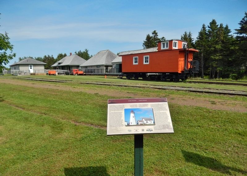
The Elmira Branch of the P.E.I. Railway opened for business on 26 October 1912, one of the last expansions of rail service in the province. The terminus at Elmira was similar to other "ends," with an engine house and . . . — — Map (db m141203) HM
Near Elmira Road, 1.6 kilometers south of Northside Road (Prince Edward Island Route 16), on the right when traveling south.
English:
Elmira became the new eastern terminus of the P.E.I. Railway in 1912 when the main line was extended from Harmony. The early decades of the 1900s were the last period of expansion for the provincial railway. They were . . . — — Map (db m141204) HM
Near Lighthouse Road, 2 kilometers east of East Point Road (Prince Edward Island Route 16), on the right when traveling east.
English:
The original fog alarm building was added to the East Point Light Station in 1885 as a navigational aid. It was replaced in 1908 with a larger building at a cost of $8000.00, and remains one of the few intact fog alarm . . . — — Map (db m140620) HM