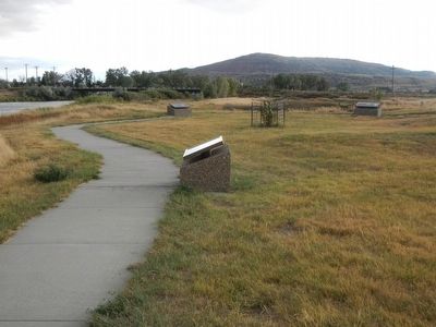
On Bessemer Bend Road (Route 308) near Speas Road (Route 311), on the right when traveling east.
Bessemer (1888-1892) was one of many small towns that grew quickly in late nineteenth century Wyoming. Early explorers and traders had discovered crude oil seeping to the surface of the ground in this area. One nearby oil spring drew the attention . . . — — Map (db m91990) HM
Near Fort Caspar Road 0.1 miles west of Wyoming Route 258, on the right when traveling west.
On April 9, 1889, application was made to have the town of Casper incorporated. John Merritt made the application in Rawlins, Wyoming since Casper was in Carbon County at that time. On July 8, 1889, Casper was incorporated and George Mitchell was . . . — — Map (db m164529) HM
On 9th Street near Southwest Wyoming Boulevard, on the left.
First commercial ferry on the Platte River was established 1/2 mile south of here in June 1847 by “Mormon” pioneers on their way to the valley of the Great Salt Lake. Brigham Young directed nine men to remain to operate the ferry. They . . . — — Map (db m91916) HM
Near Fort Caspar Road 0.1 miles west of Wyoming Route 258, on the right when traveling west.
The first passenger train arrived in this area on June 15, 1888 as part of Fremont, Elkhorn & Missouri Valley Railroad System at the site of an “old town” that would later become Casper, Wyoming. A depot was built after the tracks were . . . — — Map (db m164526) HM
On Bessemer Bend Road (County Route 308) near Speas Road (County Route 311), on the right when traveling east.
Permanent settlers began claiming this region by the late 1870s, at the end of the Plains Indian wars. The nearby Goose Egg Ranch dates to 1877 when the Searight Brothers Cattle Company trailed more than 20,000 head of cattle into Wyoming Territory. . . . — — Map (db m91979) HM
On West Yellowstone Highway (U.S. 26) at South Poplar Street (Wyoming Highway 220), on the left when traveling west on West Yellowstone Highway.
Drilling rigs of this type were used from about 1878 into the 1950's. With the drilling of deeper wells, starting in the 1920's, cable-tool drilling was gradually replaced by more modern rotary-drilling methods. This replica was built using plans . . . — — Map (db m95586) HM
On N Center Street at E A Street, on the left when traveling south on N Center Street.
Pioneer Monument Erected on this site of the Old Oregon Trail in memory of the pioneers who blazed the way. Built by Natrona County Pioneer Association 1849 1911
Fort Casper ---------- U. S. Military Post Established about 1864 by . . . — — Map (db m86897) HM
Near Fort Caspar Road 0.1 miles west of Wyoming Route 258, on the right when traveling west.
Brigham Young led the first group of Mormons west from winter quarters in Nebraska in 1847, finally settling in the Salt Lake Valley. When these pioneers crossed the river here, they left nine men to operate a ferry. This ferry served fellow Mormons . . . — — Map (db m164517) HM
Near Fort Caspar Road near South West Wyoming Boulevard (Wyoming Highway 258), on the left when traveling west.
These fort buildings were reconstructed on the original site in 1936 by the Works Progress Administration. The WPA was a government program created during the Great Depression to provide jobs for the unemployed.
Prior to his death on July 26, . . . — — Map (db m91702) HM
On Fort Caspar Road 0.1 miles west of Wyoming Route 258, on the right when traveling west.
The famous Salt Creek oil field is located in Natrona County, 40 miles north of Casper. Representative Stephen W. Downey was the first man to acquire land at Salt Creek in 1883, after the discovery of the Jackass Spring oil seep. The discovery oil . . . — — Map (db m164528) HM
Thin black lines indicate changes in relevance. Between each pair of lines entries are ordered geographically but all have the same relevance.
* Inflectional forms of words are their plurals, singulars, and possessives as well as gramatical tenses and similar variations.