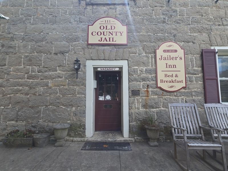
On Louisville/Bardstown Road (U.S. 31E/150) 0 miles north of Wheeler Wright Lane, on the right when traveling north.
The first settlement in Nelson County, KY. Three miles east of this spot stood Cox's Station, established in 1775 by Colonel Isaac Cox, a Colonial and Revolutionary War officer who came from Virginia to Kentucky and who was killed by the Indians in . . . — — Map (db m74267) HM
Near Main Street, on the right when traveling north.
The 40-et-8 box car was a standard European Box Car made in France and used during WWI and WWII. During both wars, the
boxcar was used to transport 40 soldiers or 8 mules or horses around Europe.
After WWII the French people donated one car to . . . — — Map (db m267120) HM
On Taylorsville Road (State Road 155) south of Six Mile Lane, on the right when traveling south.
The first Lutherans in and around Brunerstown, now Jeffersontown, were early settlers from Va., Md., Pa., and N.C. Samuel Mau, licensed to preach in Kentucky in 1789, served German-speaking churches in Jeffersontown, Nelson County, and Danville . . . — — Map (db m161800) HM
Near Freeman Lake Park Road at City Street-1197-20, on the left when traveling east.
Christopher Miller Successfully Secures Peace Treaty
In June 1782, Christopher Miller, a boy about twelve or thirteen years old, was taken prisoner by the Shawnee Indians, in the then county of Jefferson, now Nelson county, in . . . — — Map (db m252991) HM
On Beechland Road (Kentucky Route 438) at Lincoln Park Road ( Route 528), on the left when traveling east on Beechland Road.
Pioneer Spirit
The westward movement was an enticement felt by many nineteenth century families, and the Lincolns were in the heart of it. A friend of the family was the infamous frontiersman Daniel Boone, and it has been reasoned that . . . — — Map (db m46249) HM
On West Main Street (U.S. 31W) just east of South 3rd Street, on the left when traveling west.
Distillery owner Richard Cummins built a second facility next to Coon Hollow called Big Springs. By the 1890s, the two distilleries had six bonded warehouses containing some 25,000 barrels of whiskey.
In addition to their own brands, the . . . — — Map (db m178301) HM
On Kentucky Route 144 0.2 miles west of Knottsville St Lawrence Road.
In 1795, James Knott emigrated from Maryland to Cox’s Creek Settlement in Nelson County, Ky., as part of the “League of Catholic Families.” Born in 1797, his son Leonard married Mary M. Drury and moved to Daviess County in 1826. They . . . — — Map (db m47838) HM
On East Dixie Avenue (Kentucky Route 61) at South Crestwood Street, on the left when traveling north on East Dixie Avenue.
"The Parrott gun was placed in the pike; it was opened as soon as the last message from Colonel Smith was received; and, as suddenly as if its flash had ignited them, Palmer's four guns roared out from the hill on the left of the road, about six . . . — — Map (db m170819) HM
On Louisville Road (U.S. 150) at Sullivan Lane, on the right when traveling south on Louisville Road.
Froman’s Road and Station
One mile to the northwest, Paul Froman, grandson of pioneer Joist Hite, cut his wagon road in 1781 from the Salt River stations near Bullitt’s Lick to his new station (1782) on the east side of Froman’s Creek. . . . — — Map (db m72335) HM
On North 3rd Street, on the right when traveling north.
Bardstown was founded in 1780 with 33 lots offered to start. Ms. Lydia Patrick was the first known resident by 1784, on lot 50 at the north end near Blackberry Alley. In the loss of her Husband to the Indians on the exodus trip to Kentucky, she . . . — — Map (db m255862) HM
Thin black lines indicate changes in relevance. Between each pair of lines entries are ordered geographically but all have the same relevance.
* Inflectional forms of words are their plurals, singulars, and possessives as well as gramatical tenses and similar variations.