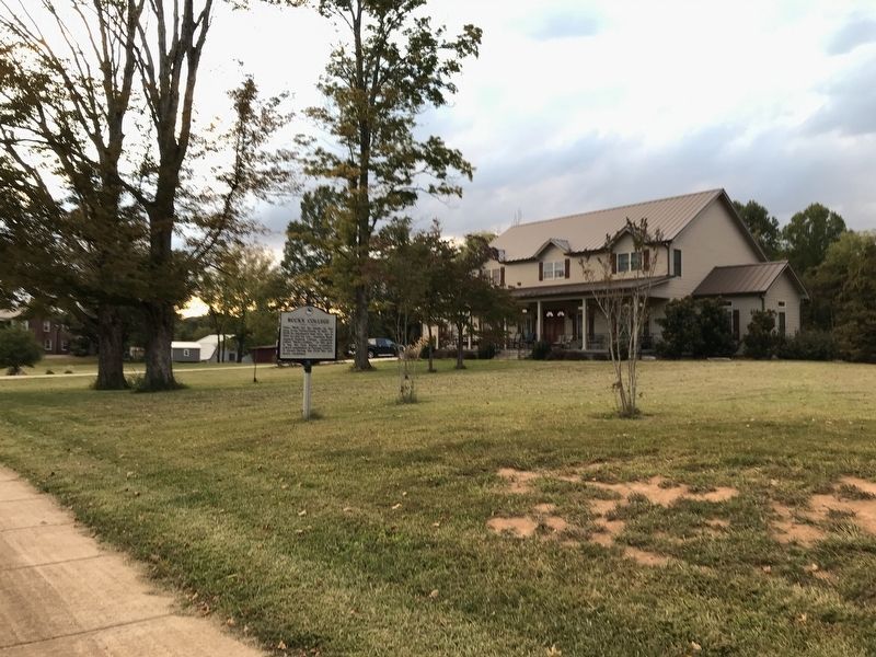
On East Broad Street 0.2 miles east of Hillside Drive, on the left when traveling east.
Isaac Buck led his family to this area from Pennsylvania in 1820. In 1849 he purchased land here, and in 1852 he and his son, Jonathan Buck, opened Andrew College, commonly
called “Buck's College,” at this spot. It was the first known . . . — — Map (db m157380) HM
On East Broad Street at Fleming Avenue, on the right when traveling east on East Broad Street.
Major Cooke (1789-1870), b. Culpepper County, Virginia, veteran of the War of 1812, with his wife Margaret Cox settled on a farm about nine miles southwest of here in 1816. As a
State Senator, 1851-55, he secured passage of a bill refounding Putnam . . . — — Map (db m157390) HM
On Buffalo Valley Road east of Deer Creek Drive, on the left when traveling east.
Born in Virginia in 1787, Major Cooke served with Andrew Jackson in the War of 1812. Moving to Tennessee with his family in 1816, Cooke settled nine miles southwest of Cookeville, acquiring 3000 acres. Serving in the Tennessee Senate, 1851-1854, . . . — — Map (db m182564) HM
On U.S. 70N at Brown's Mills Road, on the right when traveling north on U.S. 70N.
The first church services were held one-mile due east, on the south bank of Falling Water River. Joshua Bartlett founded the church after relocating to Tennessee from Boonesborough, Kentucky and began church services in his log house. Recognized as . . . — — Map (db m263867) HM
On East Spring Street (U.S. 70 N) at South Jefferson Avenue, on the right when traveling west on East Spring Street.
During his lifetime, Jere Whitson was a devoted and public spirited citizen of Putnam County. It was through his leadership that progressive movements of his era led the way for the progress
of today. His accomplishments were many, such as . . . — — Map (db m262361) HM
On Depot Street at North Cedar Avenue, on the right when traveling west on Depot Street.
Putnam County was a divided land during the Civil War as local residents enlisted in either Federal or Confederate units. It also was a crossroads, as both armies passed through the county numerous times over such important historic roads as the . . . — — Map (db m159208) HM
On Gainesboro Grade (State Highway 290) south of Farmington Drive, on the right when traveling south.
Built in the 1830s, the Shipley Barn is one of the oldest structures in Putnam County. A
uniquely preserved example of half-dovetail notched log construction, it was built by master craftsmen for Abraham Buck, a leading Upper Cumberland pioneer and . . . — — Map (db m157377) HM
Left Panel Fort Couch was built as part of the emergency fortifications erected to defend Harrisburg and nearby bridges across the Susquehanna River during the 1863 invasion of Pennsylvania by Confederate forces. Fort Couch was built as an . . . — — Map (db m216436) HM
Near Buffalo Valley Road east of Deer Creek Drive, on the left when traveling east.
Major Richard Fielding Cooke was one of the most prominent pioneer citizens of Putnam County. As a member of the General Assembly in its 1853-54 session he was untiring in his efforts to secure the re-establishment of Putnam County. On February 11, . . . — — Map (db m182566) HM
On West Marion Street at South Madison Avenue, on the right when traveling east on West Marion Street.
Eatonton's “Liberty Pole,” erected after Georgia's secession in 1861, towered 102 feet above the Putnam County Court House grounds holding an oversized flag. Approximately 10,000 Putnam County residents produced six infantry companies for . . . — — Map (db m197750) HM
On Courthouse Drive at Emergency Lane / Sabre Street, on the right when traveling south on Courthouse Drive.
A Microcosm
Historians use the word microcosm as shorthand to show that a piece is
representative of the whole. “A house divided against itself,” Putnam
County sent approximately 10% of its population to war, nearly half to . . . — — Map (db m137355) HM
Thin black lines indicate changes in relevance. Between each pair of lines entries are ordered geographically but all have the same relevance.
* Inflectional forms of words are their plurals, singulars, and possessives as well as gramatical tenses and similar variations.