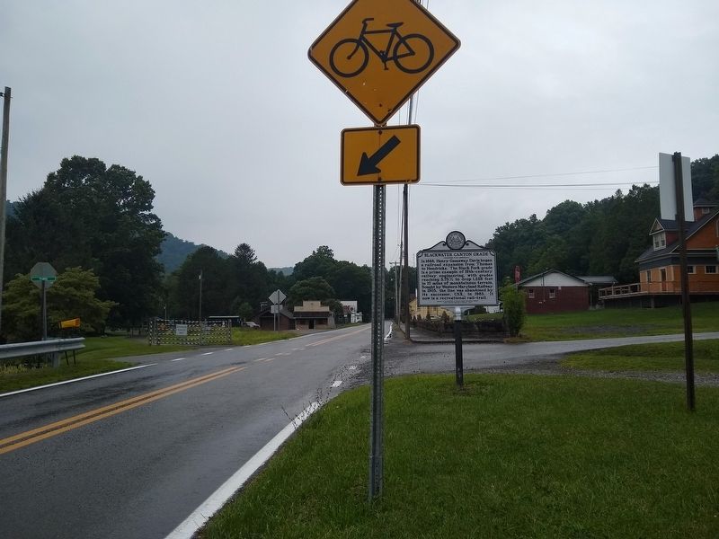
On Main Street (West Virginia Route 72) near Blackwater Canyon Trail, on the right when traveling west.
In 1888, Henry Gassaway Davis began a railroad expansion from Thomas to Hendricks. The Black Fork grade is a prime example of 19th-century railway engineering, with grades reaching 3.75% to drop 1,236 feet in 10 miles of mountainous terrain. Bought . . . — — Map (db m229947) HM
On First Street (U.S. 219) west of Walnut Street, on the right when traveling south.
In 1892, Coketon Colored School teacher Carrie Williams sued the local school board for equal pay. She was represented by the first African American lawyer in WV, J.R. Clifford, in front of Judge Hoke. Local jury found for her and she won appeal at . . . — — Map (db m74854) HM
On 1st Street (U.S. 219) at Walnut Street, on the right when traveling west on 1st Street.
1861 - 1865 Corrick's Ford Battle engagement between Federal troops under Gen. T.A. Morris and Confederate troops under Gen. R.S. Garnett, one mile south, July 13, 1861. Garnett, mortally wounded in this action, was the first general to . . . — — Map (db m33621) HM
On Douglas Road / Front Street (County Route 27) 0.5 miles south of Appalachian Highway ( Route 32), on the left when traveling south.
Segregated school located along the North Fork of the Blackwater that served Coketon, center of coal and coke empire of H. G. Davis. In 1892 teacher Carrie Williams, represented by J. R. Clifford, state’s first African Amerian lawyer, sued when . . . — — Map (db m82119) HM
On Douglas Road (County Road 27) at Dobbins Road (County Road 27/5), on the left when traveling west on Douglas Road.
Underground coal mining is dangerous and labor-intensive. Mine tunnels required careful engineering, and the Davis Coal and Coke Company built this Engineering Building to enable planning for efficient operations and good record-keeping. A . . . — — Map (db m153052) HM
On Douglas Road (County Road 27) at Dobbin Road (County Road 27/5) on Douglas Road.
A company store provided an industrial community with the necessities of life—as well as a means for a company to control its workforce. Lured by the lucrative prospect of mining coal for steelmaking, Henry Gassaway Davis and other . . . — — Map (db m153053) HM
On Appalachian Highlands Trail, a walking trail, on the right when traveling east.
"No shaft of shining marble, new From the sculptor's hand we raise for you No, here we lay A boulder drawn from the river-side Where brave men battled and bled and died." Karl Myers, Ode to the Battle of Corricks Ford, 1926 On US Route . . . — — Map (db m23766) HM
On William Avenue (West Virginia Route 32/24) west of Fifth Street ( Route 32/21), on the right when traveling east.
Although West Virginia was not universally a "Jim Crow" segregated state, state law required separate facilities for schooling. Davis and Coketon, a community near Thomas, each had separate schools for African American students. The African . . . — — Map (db m236910) HM
On Capitol Street just east of Lee Street (U.S. 60), on the left when traveling east.
Davis Park was originally developed in 1906 by former U.S. Senator Henry Gassaway Davis (1823-1916). Senator Davis was a self-made millionaire successful in the rail, mining and banking industries. He was elected to the U.S. Senate from West . . . — — Map (db m232885) HM
Near Laurel Mountain Road (County Route 15), on the right when traveling east.
Confederate forces retreated from this area after the "Philippi Races" (June 3, 1861), first land battle of the Civil War. At Huttonsville, 26 miles south, Confederate General Robert S. Garnett took command of the Army of the Northwest. His goal was . . . — — Map (db m253810) HM
On Route 9 Bike Path south of Short Road (County Route 9/19), on the right when traveling north.
Stone House Mansion, predominantly Georgian in style, was constructed in 1757, and is one of the oldest stone structures in Berkeley County. The property is listed in the National Register of Historic Places for its association with the Hite vs. . . . — — Map (db m167518) HM
On Appalachian Highway (West Virginia Route 32) at 3rd Street, on the left when traveling north on Appalachian Highway.
The Thomas National Register Historic District is considered significant under Criterion A for its association with the settlement and development of Thomas and of Tucker County.
Though remote, the area has been of interest to explorers . . . — — Map (db m153055) HM
On Appalachian Highway (West Virginia Route 32), on the right when traveling south.
The Railroad
The West Virginia Central and Pittsburg (WVC&P) (Former Railyard, Tour No. 36) was founded by Henry Gassaway Davis, one of the most important figures in West Virginia history.
Davis began his career as a . . . — — Map (db m153060) HM