13 entries match your criteria.
Historical Markers
in the Southern Rockies and Foothills Region
By Dawn Bowen, June 30, 2008
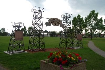
Turner Valley Gas Plant Marker
| On Main Street (Provincial Highway 22) at Valley Trail (Provincial Highway 546), on the right when traveling north on Main Street. |
| On Main Street Northwest (Provincial Highway 22) at Valley Trail (Route 546), on the right when traveling north on Main Street Northwest. |
| On Breckenridge Avenue at Railway Street, on the right when traveling south on Breckenridge Avenue. |
| On Alberta 6, on the right when traveling north. |
| On Akamina Parkway (Local Road 14A) 8 kilometers west of Provincial Highway 5, on the right when traveling south. |
| Near Akamina Parkway 7 kilometers west of Alberta Highway 5, on the left when traveling west. |
| On Evergreen Avenue south of Cameron Falls Drive, on the right when traveling south. |
| On Evergreen Avenue south of Cameron Falls Drive, on the right when traveling south. |
| On 1 Street West (Provincial Highway 2) at 52 Avenue West, on the right when traveling north on 1 Street West. |
| On 50 Avenue West at 2 Street West, on the left when traveling west on 50 Avenue West. |
| On 2 Avenue just north of 22 Street, on the right when traveling north. |
| On 6 Avenue (Provincial Road 811) just north of 30 Street/Water Street, on the right when traveling north. |
| On Crowsnest Highway (Provincial Highway 3) 0.1 kilometers east of 2 Avenue, on the right when traveling east. |
Oct. 16, 2026
