7 entries match your criteria.
Related Historical Markers
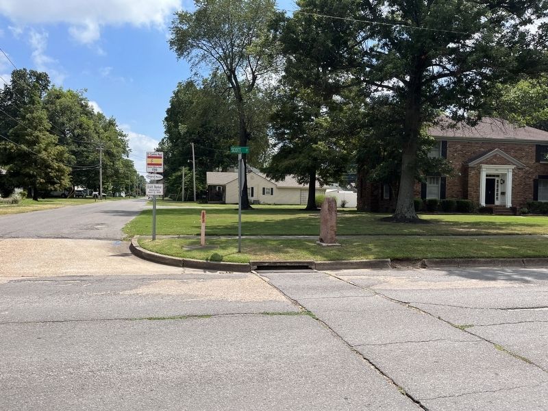
Surviving Red Granite Markers erected by the D.A.R. for the King's Highway (El Camino Real)
By Craig Swain, July 30, 2023
El Camino Real Marker
SHOWN IN SOURCE-SPECIFIED ORDER
| On Kings Highway at Scott Street, on the right when traveling south on Kings Highway. |
| On North Kingshighway near East Woodlawn Avenue, on the right when traveling north. |
| On East Missouri Street at Winchester Street (U.S. 61), on the right when traveling east on East Missouri Street. |
| On S. Spanish Street (Missouri Route 177) at William Street, on the right when traveling north on S. Spanish Street. |
| On West St. Maries Street at North Jackson Street, on the right when traveling east on West St. Maries Street. |
| On 3rd Street, on the right when traveling south. Reported damaged. |
| On 4th Street at Vine Street, on the right when traveling north on 4th Street. |
Jun. 17, 2024