2 entries match your criteria.
Related Historical Markers
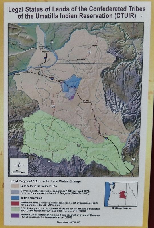
By Cosmos Mariner, July 3, 2016
Marker detail: Legal Status of Lands of the Confederated Tribes of the Umatilla Indian Reservation
SHOWN IN SOURCE-SPECIFIED ORDER
1 ► Oregon, Umatilla County, Umatilla — Patímaša Tiičámna — They are Marking the Land —  |
| On Devore Road north of 6th Street (U.S. 730), on the left when traveling north. | |||
| 2 ► Oregon, Umatilla County, Umatilla — Cayuse, Umatilla and Walla Walla Homeland — |
| On Devore Road north of 6th Street (U.S. 730), on the left when traveling north. | |||