THE HISTORICAL
MARKER DATABASE
“Bite-Size Bits of Local, National, and Global History”


5 entries match your criteria.  


Related Historical Markers

St. Augustine City Wall & Gate
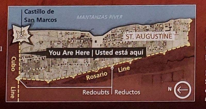
 
Marker detail: Fort, city and wall map
SHOWN IN SOURCE-SPECIFIED ORDER
1 ► Florida, St. Johns County, St. Augustine — Wall of Defense / Una ciudad amurallada — Castillo de San Marcos National Monument —
On South Castillo Drive (State Highway A1A) at Orange Street, on the right when traveling north on South Castillo Drive.
2 ► Florida, St. Johns County, St. Augustine — Safe Haven / Refugio seguro — Castillo de San Marcos National Monument —
On South Castillo Drive (State Highway A1A) at Orange Street, on the right when traveling south on South Castillo Drive.
3 ► Florida, St. Johns County, St. Augustine — This Gate Opened in 1739 —
On Orange Street at St. George Street, on the left when traveling east on Orange Street.
4 ► Florida, St. Johns County, St. Augustine — The Town Wall — 1704-1821 —
On South Castillo Drive (Business U.S. 1) at Orange Street, on the right when traveling north on South Castillo Drive.
5 ► Florida, St. Johns County, St. Augustine — The City Gate — Ironbound Doors Closed the Passage —
On South Castillo Drive (Business U.S. 1) at Orange Street, on the left when traveling north on South Castillo Drive.


CeraNet Cloud Computing sponsors the Historical Marker Database.
This website earns income from purchases you make after using our links to Amazon.com. We appreciate your support.
Paid Advertisement
Nov. 11, 2026
