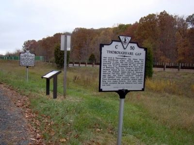
3 entries match your criteria. Related Historical MarkersThoroughfare Gap Markers By J. J. Prats, October 31, 2009 Thoroughfare Gap and Two Other Markers SHOWN IN SOURCE-SPECIFIED ORDER 1 ► Virginia, Fauquier County, Broad Run — C-50 — Thoroughfare Gap — On John Marshall Highway (Virginia Route 55) at Beverleys Mills Road, on the right when traveling west on John Marshall Highway. 2 ► Virginia, Fauquier County, Broad Run — Thoroughfare Gap — A “Dark, Gloomy Cleft” — Mosby’s Confederacy and Second Manassas CampaignOn John Marshall Highway (Virginia Route 55) at Beverleys Mill Road, on the right when traveling west on John Marshall Highway. Reported permanently removed. 3 ► Virginia, Fauquier County, Broad Run — FA-1 — Campaign of Second Manassas — On John Marshall Highway (Virginia Route 55) at Beverleys Mill Road, on the right when traveling west on John Marshall Highway. ︽