THE HISTORICAL
MARKER DATABASE
“Bite-Size Bits of Local, National, and Global History”


11 entries match your criteria.  


Shays' Rebellion Historical Markers

Shays' Rebellion was an armed uprising in Massachusetts during 1786 and 1787 in response to a debt crisis among the citizenry and in opposition to the state government's increased efforts to collect taxes on both individuals and their trades. Issues raised through this rebellion influenced the creation of the U.S. Constitution.
 
By Bill Coughlin, November 1, 2010
Marker in Great Barrington, Mass
1 ► Massachusetts, Berkshire County, Great Barrington — Last Battle of Shays Rebellion —
On Sheffield-Egremont Road north of Rebellion road, on the right when traveling north.
2 ► Massachusetts, Berkshire County, Lenox — Paterson / Egleston —
On Main Street / Old Stockbridge Road (Massachusetts Route 7A) at Walker Sreet / West Street ( Route 183), in the median on Main Street / Old Stockbridge Road.
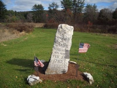
3 ► Massachusetts, Bristol County, Taunton — Shays’ Rebellion Defeat —
On Court Street near Taunton Green, on the right when traveling east.
4 ► Massachusetts, Hampden County, Springfield, McKnight — Shays’ Rebellion —
On State Street near Federal Street, on the right when traveling west.
5 ► Massachusetts, Hampshire County, Northampton — Shays' Rebellion —
On Pleasant Street (U.S. 5) at Main Street ( Route 9), on the right when traveling south on Pleasant Street.
6 ► Massachusetts, Plymouth County, Hingham — General Benjamin Lincoln House —
On North Street at Lincoln Street, on the left when traveling east on North Street.
7 ► Massachusetts, Worcester County, New Braintree — Battle of New Braintree —
On Oakham Road at Utley Road, on the right when traveling east on Oakham Road.
8 ► Massachusetts, Worcester County, Petersham — Routing of Shay's Rebellion —
On North Main Street (Massachusetts Route 122) at Common Street, on the right when traveling north on North Main Street.
9 ► Missouri, Stoddard County, Bloomfield — Major Amos Stoddard —
On South Prairie Street (County Highway AA) at Court Street, on the left when traveling south on South Prairie Street.
10 ► New York, Livingston County, Conesus — Gravesite of Captain Daniel Shays —
Near West Swamp Road (New York State Route 256) 0.8 miles south of Guiltner Road.
11 ► New York, Livingston County, Conesus — Union Cemetery —
On West Swamp Road (New York State Route 256) 0.8 miles south of Guiltner Road, on the right when traveling south.
 
 
CeraNet Cloud Computing sponsors the Historical Marker Database.
This website earns income from purchases you make after using our links to Amazon.com. We appreciate your support.
Paid Advertisement
Nov. 13, 2026
