3 entries match your criteria.
Related Historical Markers
Other Hurricane Sandy high water marks
By Devry Becker Jones (CC0), July 24, 2020
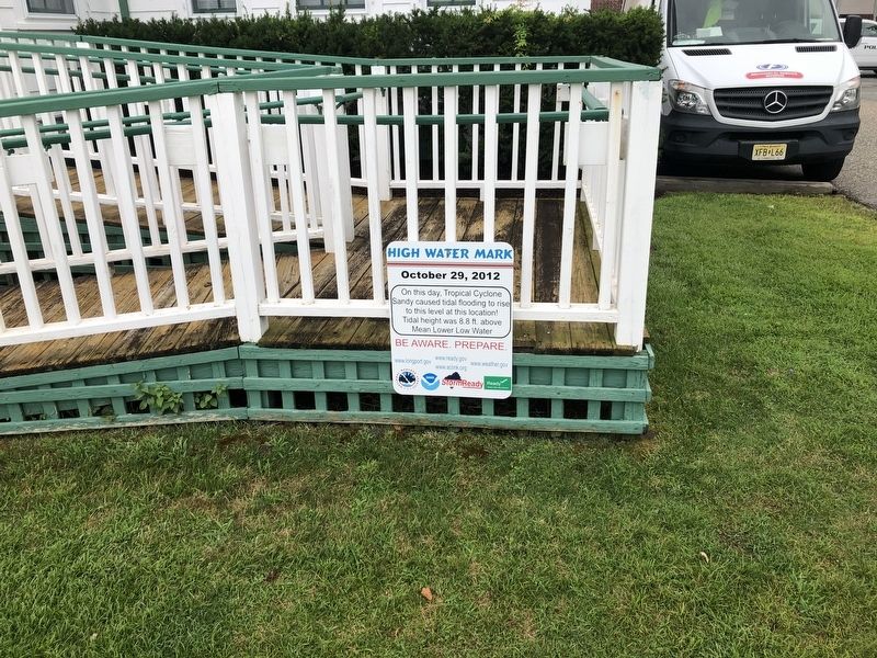
High Water Mark Marker
SHOWN IN SOURCE-SPECIFIED ORDER
| |
On this day, Tropical Cyclone Sandy caused tidal flooding to rise to this level at this location! Tidal height was 8.8 ft. above Mean Lower Low Water
Be aware. Prepare. — — Map (db m153616) HM |
| | On this day, Hurricane Sandy brought a storm surge of 5 feet to this area as indicated by the red line below.
For more information about hurricanes in NYC, visit:
NYC Emergency Management
NYC/gov/EmergencyManagement
Know Your Zone . . . — — Map (db m149067) HM |
| | On this day, Hurricane Sandy brought a storm surge of 4 feet to this location indicated by the red line.
For more information about hurricanes in NYC, visit:
Know Your Zone
NYC.gov/Know Your Zone
NYC Emergency Management . . . — — Map (db m133225) HM |
Jun. 6, 2024