THE HISTORICAL
MARKER DATABASE
“Bite-Size Bits of Local, National, and Global History”


4 entries match your criteria.  


Related Historical Markers
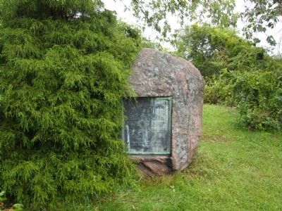
 
By Bryan Simmons, 2011
Myles Garrison House Site Marker
SHOWN IN SOURCE-SPECIFIED ORDER
1 ► Massachusetts, Bristol County, Swansea — Myles Garrison House Site —

Near this spot stood the John Myles Garrison House. The place of meeting of the troops of Massachusetts Bay and Plymouth colonies. Commanded by Majors Thomas Savage and James Cudworth, who marched to the relief of Swansea at the opening of . . . — — Map (db m299489) HM WM
2 ► Massachusetts, Bristol County, Swansea, Gardner's Neck — HA-16;902 — Bourne Garrison King Philip's War —
The Site of Bourne Garrison King Philip's War June - 1675 — — Map (db m289774) HM WM
3 ► Rhode Island, Bristol County, Bristol — Mount Hope — Sacred Land of the Pokanokets — A Sowams Heritage Area Site —
Mount Hope (originally Montaup in the Pokanoket language) is a wooded promontory on the eastern shore of Bristol, Rhode Island overlooking the part of Narragansett Bay known as Mount Hope Bay. Before the European settlers arrived in New England, . . . — — Map (db m301431) HM
4 ► Massachusetts, Bristol County, Dighton — Dighton Council Oak — Meeting Place of the Wampanoag Indians —
Dighton Council Oak Meeting Place of the Wampanoag Indians Here King Philip met with his braves. This tree marks the center of the “old field”. Near here was the largest Indian settlement in Dighton. — — Map (db m301420) HM WM


CeraNet Cloud Computing sponsors the Historical Marker Database.
This website earns income from purchases you make after using our links to Amazon.com. We appreciate your support.
Paid Advertisement
Oct. 9, 2026