2 entries match your criteria.
Related Historical Markers
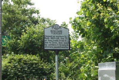
By Mike Stroud, May 19, 2012
Buncombe Turnpike Marker
SHOWN IN SOURCE-SPECIFIED ORDER
1 ► North Carolina, Buncombe County, Asheville, Montford Area Historic District — P-77 — Buncombe Turnpike —  |
| Opened up western N.C. Built, 1824-28; the 75-mi. long route from S.C. line to Tenn. line, used by settlers & livestock drovers, passed nearby. — — Map (db m55544) HM | |||
| 2 ► North Carolina, Madison County, Marshall — Buncombe Turnpike — |
| "Completed in 1827 from Saluda Gap to Buncombe County Court House and along the French Broad River by way of Barnard's and Warm Springs to Tennessee line. Served as the major trade route through mountains of western North Carolina until 1882." — — Map (db m23690) HM | |||