THE HISTORICAL
MARKER DATABASE
“Bite-Size Bits of Local, National, and Global History”


9 entries match your criteria.  


Related Historical Markers

 
By David Weed, April 20, 2023
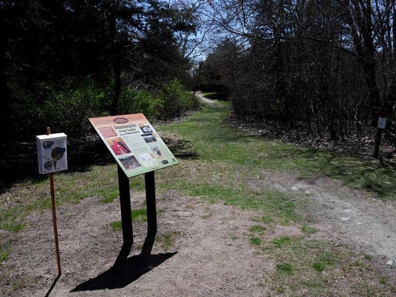
Osamequin Marker
SHOWN IN SOURCE-SPECIFIED ORDER
1 ► Rhode Island, Bristol County, Barrington — Osamequin — Great Leader of the Pokanokets —
Osamequin Nature Preserve and Bird Sanctuary is named in honor of the Massasoit (Great Leader) Osamequin (or Ousamequin) of the Pokanoket Tribe. Osamequin, which means Yellow Feather, led his people in helping the settlers of the Plymouth Colony . . . — — Map (db m282075) HM
2 ► Massachusetts, Plymouth County, Plymouth — Massasoit —
Great Sachem of the Wampanoags protector and preserver of the Pilgrims 1621 — — Map (db m299589) HM
3 ► Massachusetts, Norfolk County, Weymouth, North Weymouth — Puddingstone Memorials —
On October 21, 2001 these puddingstone memorials were dedicated as symbols of hope that the souls of the first inhabitants of Wessagussett, the Massachusetts Indians and the first settlers of Weymouth, the Weston Colonists, have . . . — — Map (db m295969) HM
4 ► Massachusetts, Norfolk County, Weymouth, North Weymouth — Settlement of Weymouth —
In commemoration of the three hundredth anniversary of the settlement of Weymouth and the encounter of the settlers under Miles Standish with the Indians in March 1623 when the Indian Chiefs Pecksuot and Wituwaumet were killed thereby . . . — — Map (db m295954) HM
5 ► Rhode Island, Newport County, Little Compton — Colonel Benjamin Church —
One hundred twenty-two rods west by north from this stone lived the famous Indian fighter Colonel Benjamin Church — — Map (db m307063) HM WM
6 ► Rhode Island, Bristol County, Bristol — Mount Hope — Sacred Land of the Pokanokets — A Sowams Heritage Area Site —
Mount Hope (originally Montaup in the Pokanoket language) is a wooded promontory on the eastern shore of Bristol, Rhode Island overlooking the part of Narragansett Bay known as Mount Hope Bay. Before the European settlers arrived in New England, . . . — — Map (db m301431) HM
7 ► Rhode Island, Washington County, Narragansett, Point Judith — "Chief Canonchet" —
Canonchet was the son of Miantonomi and the great-nephew of Canonicus, the co-sachems who welcomed Roger Williams in 1636. Canonchet was the war leader of the Narragansetts when the United Colonies (Plymouth, Massachusetts Bay, and . . . — — Map (db m306438) HM WM
8 ► Rhode Island, Washington County, South Kingstown, West Kingston — The Great Swamp Fight — 19 December 1675 —
Attacked within their fort upon this island the Narragansett Indians made their last stand in King Philip's War and were crushed by the united forces of the Massachusetts Connecticut and Plymouth Colonies in the “Great Swamp Fight” . . . — — Map (db m300554) HM
Paid Advertisement
9 ► Rhode Island, Bristol County, Bristol — In the Miery Swamp — King Philip Fell —
In the 'Miery Swamp,' 100 feet W.S.W. from this spring, according to tradition, King Philip fell, August 12, 1676, O.S. — — Map (db m307142) HM
 
 
CeraNet Cloud Computing sponsors the Historical Marker Database.
This website earns income from purchases you make after using our links to Amazon.com. We appreciate your support.
Paid Advertisement
Oct. 1, 2026
