Narragansett Pier in Washington County, Rhode Island — The American Northeast (New England)
"Chief Canonchet"
Photographed by G.W.Bartlett, July 12, 2026
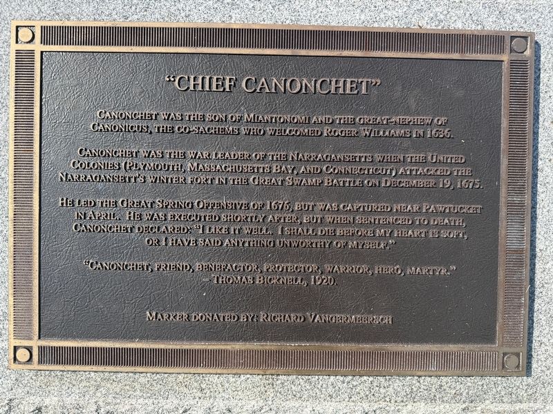
1. Chief Canonchet Marker
Canonchet was the son of Miantonomi and the great-nephew of Canonicus, the co-sachems who welcomed Roger Williams in 1636.
Canonchet was the war leader of the Narragansetts when the United Colonies (Plymouth, Massachusetts Bay, and Connecticut) attacked the Narragansetts’ winter fort in the Great Swamp Battle on December 19, 1675.
He led the Great Spring Offensive of 1676, but was captured near Pawtucket in April. He was executed shortly after, but when sentenced to death, Canonchet declared: "I like it well. I shall die before my heart is soft, or I have said anything unworthy of myself."
"Canonchet, friend, benefactor, protector, warrior, hero, martyr." - Thomas Bicknell, 1920.
Marker donated by: Richard Vangermeersch
Erected 1977.
Topics and series. This memorial is listed in these topic lists: Colonial Era • Indigenous Peoples and Communities • Wars, US Indian. In addition, it is included in the King Philip's War 1675-1676 series list. A significant historical year for this entry is 1675.
Location. 41° 25.9′ N, 71° 27.42′ W. Memorial is in Narragansett, Rhode Island, in Washington County.
this page online

Regionally, this memorial is on Narragansett Bay and in South County. It is also in the American Northeast, in New England, and on the Eastern Seaboard. Globally, it is in the North Atlantic Region, North America, the Western Hemisphere, the Western World, and the Anglosphere. Historically, it finds itself in what was once one of the original Thirteen Colonies.
Other nearby markers. At least 8 other markers are within 4 miles of this marker, measured as the crow flies: “Prisoners of Conscience“ (a few steps from this marker); The Narragansett Pier (about 700 feet away, measured in a direct line); Honor Roll Town of Narragansett World War (approx. 0.6 miles away); Carter Jackson Monument (approx. 1.4 miles away); Griffin's Hollow (approx. 2.2 miles away); Pettaquamscutt Rock (approx. 2.7 miles away); Whale Rock Lighthouse (approx. 3.2 miles away);
Photographed by G.W.Bartlett, July 12, 2026
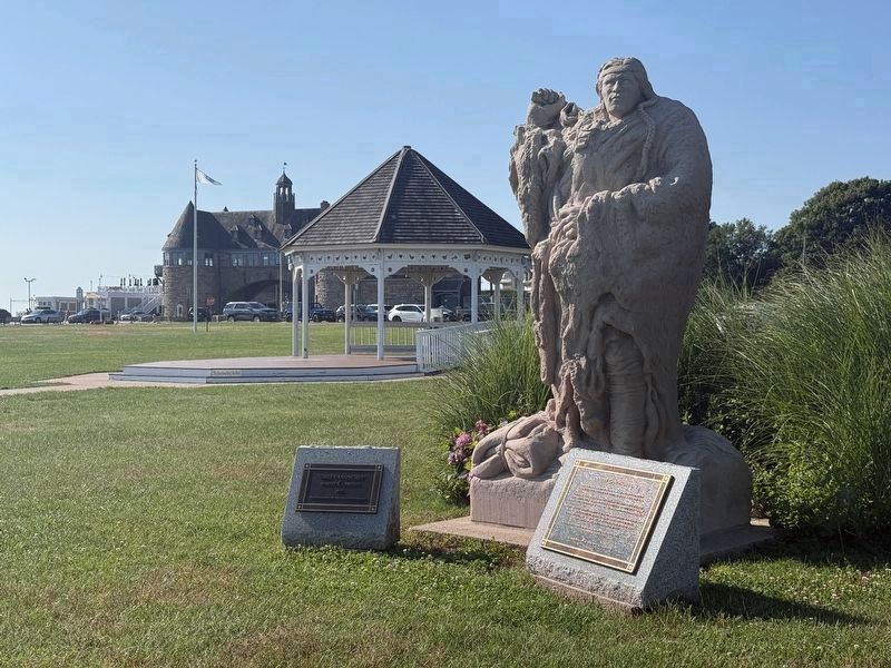
2. Chief Canonchet Marker
( small plaque on left )
“Chief Canonchet”
by
Robert K. Carsten
1977
Marker donated by: Richard Vangermeersch
by
Robert K. Carsten
1977
Marker donated by: Richard Vangermeersch
Related markers. Click here for a list of markers that are related to this marker. Information about Pierce's Fight and Canonchet's father Miantonimo
Also see . . .
1. Canonchet (Wikipedia). (Submitted on July 13, 2026, by Michael Herrick of Southbury, Connecticut.)
2. Canonchet Brook Preserve. Canonchet Brook Preserve in nearby Hopkinton, Rhode Island is also within the Narragansetts’ historical territor and named after Chief Canonchet.
More than 6 miles of marked trails take hikers across a rugged landscape of boulders, rocky outcrops and swampy lowlands… The Canonchet Brook Preserve is part of a large, healthy forest near the Rhode Island/Connecticut border. It protects the headwaters of Canonchet Brook and Tomaquag Brook, tributary streams to the Wood-Pawcatuck National Wild and Scenic River.(Submitted on July 16, 2026, by G.W.Bartlett of Hingham, Massachusetts.)
Photographed by G.W.Bartlett, July 12, 2026
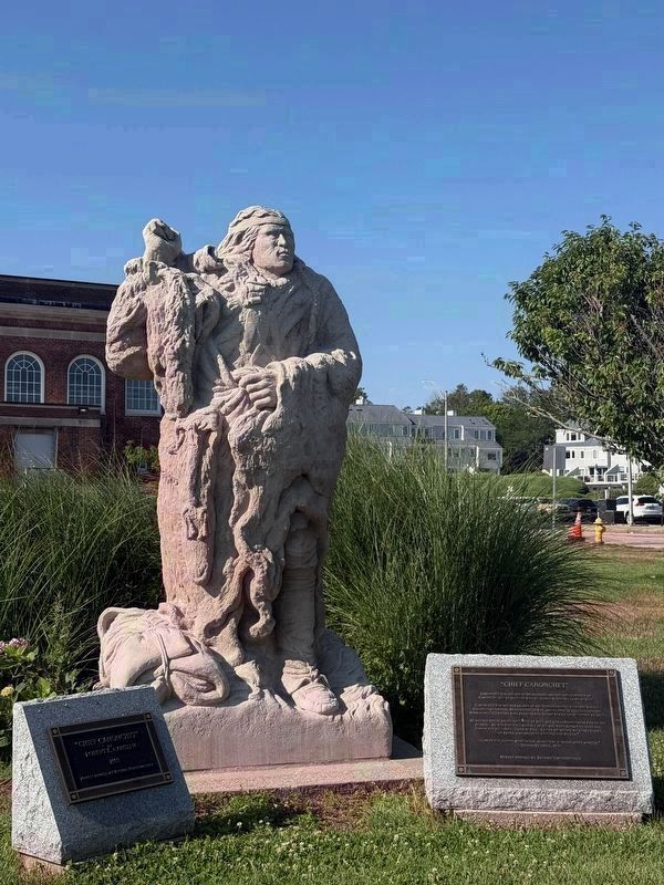
3. Chief Canonchet
Photographed by G.W.Bartlett, July 12, 2026
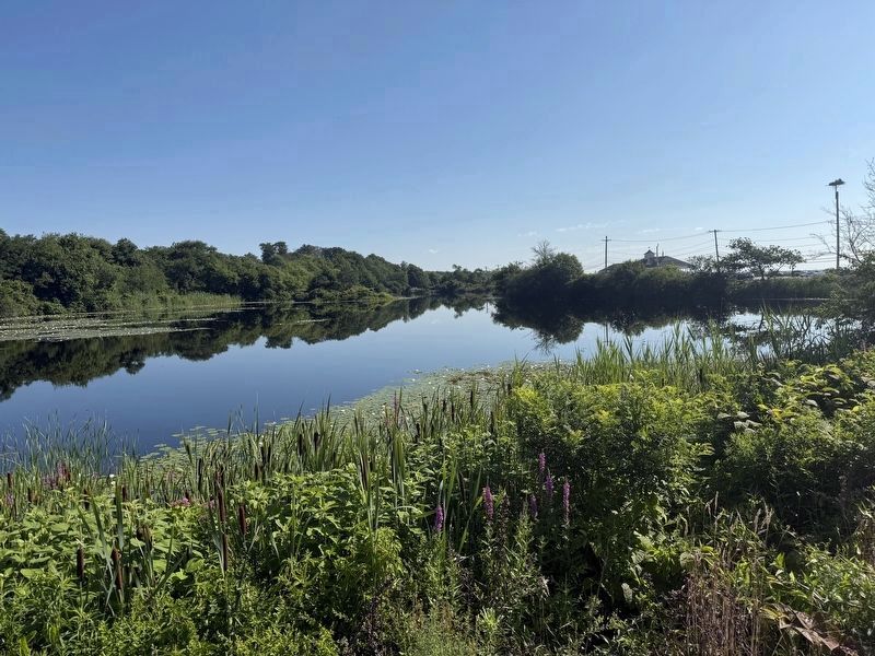
4. Lake Canonchet
Just northwest of the Chief Canonchet statue, behind Narragansett Beach.
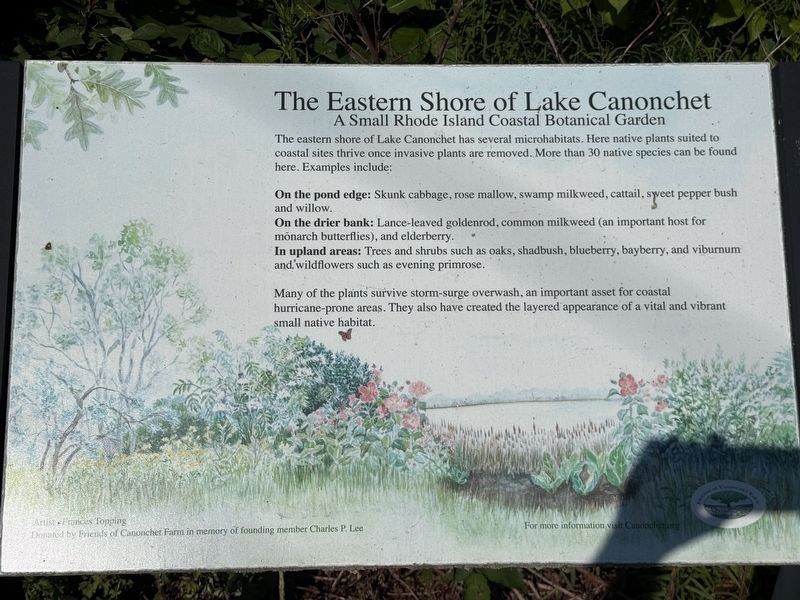
Photographed by G.W.Bartlett, July 12, 2026
5. The Eastern Shore of Lake Canonchet
Credits. This page was last revised on July 23, 2026. It was originally submitted on July 12, 2026, by G.W.Bartlett of Hingham, Massachusetts. This page has been viewed 38 times since then. Last updated on July 23, 2026, by G.W.Bartlett of Hingham, Massachusetts. Photos: 1, 2, 3, 4, 5. submitted on July 12, 2026, by G.W.Bartlett of Hingham, Massachusetts. • Devry Becker Jones was the editor who published this page.
