4 entries match your criteria.
Related Historical Markers
These markers interpret the grounds of Magnolia Grange.
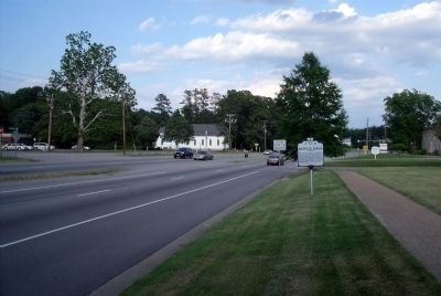
By Bernard Fisher, May 30, 2009
Magnolia Grange Marker on Iron Bridge Road (facing east).
SHOWN IN SOURCE-SPECIFIED ORDER
| On Iron Bridge Road (Virginia Route 10) at Krause Road, on the right when traveling east on Iron Bridge Road. |
| Near Iron Bridge Road (Virginia Route 10) east of Courtview Lane, on the left when traveling west. |
| Near Iron Bridge Road (Virginia Route 10) east of Courtview Lane, on the left when traveling west. |
| Near Iron Bridge Road (Virginia Route 10) east of Courtview Lane, on the left when traveling west. |
Nov. 10, 2026
