
Near Winchester in Frederick County, Virginia — The American South (Mid-Atlantic)
The Advance of Tyler’s Brigade
Photographed by Craig Swain, October 20, 2007
1. The Advance of Tyler's Brigade Marker
A Virtual Tour of the Battle of Kernstown by HMDb markers.
Click for more information.
Click for more information.
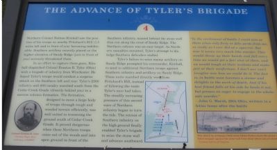
Northern Colonel Nathan Kimball saw the position of his troops on nearby Pritchard's Hill (1.5 miles left and in front of you) becoming indefensible. Southern artillery recently placed on the higher elevation of Sandy Ridge (just in front of you) seriously threatened them.
In an effort to capture these guns, Kimball dispatched Colonel Erastus B. Tyler (Ohio) with a brigade of infantry from Winchester. He hoped Tyler's troops would conduct a surprise attack on the Southern left and rear. Tyler's 2300 infantry and 400 cavalry marched south from Cedar Creek Grade (directly behind you) in a narrow column formation. The formation, designed to move a large body of troops through rough and wooded terrain efficiently, was well suited to traversing the ground south of Cedar Creek Grade. It proved dangerous when these Northern troops came out of the woods and into open ground in front of the Southern infantry, massed behind the stone wall that ran along the crest of Sandy Ridge. The Northern column was an easy target. As Northern casualties mounted, Tyler's attempt to dislodge Southern defenders stalled.
Tyler's failure to seize enemy
this page online
"In the excitement of battle I could aim at them only fourty or fifty yards from me, as coolly as I ever did at a squirrel. But now it seams very much like murder. They would throw up their hands and fall every time we would get a fair shot at them, and we would laugh at their motions and make jest at their misfortune. I don't nor can't imagine now how we could do it. The fact is, in battle a man becomes a sinner and delights at the work of death. And if his best friend falls at his side he heeds it not, but presses on eager to engage in the wholesale murder."(Marker Number 4.)
-John G. Marsh, 29th Ohio, written in a letter home after the battle
Topics.
Photographed by Craig Swain, October 20, 2007
2. Walking Tour Stop Four for Rose Hill
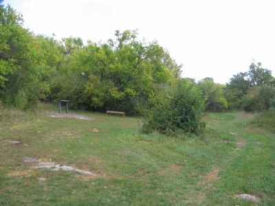
Location. This marker has been replaced by another marker nearby. It was located near 39° 9.285′ N, 78° 12.906′ W. Marker was near Winchester, Virginia, in Frederick County. It could be reached from Jones Road (County Route 621), on the right when traveling north. Located at stop four of the walking tour of Rose Hill. See the link to the Museum of the Shenandoah for details about visiting Rose Hill. Touch for map. Marker was at or near this postal address: 1985 Jones Road, Winchester VA 22602, United States of America. Touch for directions.

Regionally, this marker was in Virginia’s Shenandoah Valley. It was also in the American South, specifically in the Upper South, and in the Mid-Atlantic. Globally, it was in North America, the Western Hemisphere, the Western World, and the Anglosphere. Historically, it found itself in what was once the territory of the Mississippian Culture, one of the original Thirteen Colonies, one of the Confederate States of America, and the Antebellum South.
Other nearby markers. At
Photographed by Craig Swain, October 20, 2007
3. Tyler's Advance
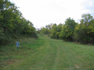
The walking trail traverses the same ground Tyler's brigade marched across during their advance. Here is a good example of the constraining terrain forcing the column into a narrow, compact formation. The Confederates were positioned behind stone walls beyond the next rise, easily hidden from the advancing Federals.
Other markers no longer nearby. The Order for Retreat (was about 400 feet away, measured in a direct line but has been replaced with another marker now near it); The Defense of the Stone Wall (was about 500 feet away but has been replaced with another marker now near it); Northern Victory, Southern Defeat (was approx. 0.2 miles away but has been replaced with another marker now near it).
More about this marker. On the lower left of the marker is a portrait of Colonel Erastus B. Tyler. In the lower center is a map of
Photographed by Craig Swain, October 20, 2007
4. West Side of Battle Area
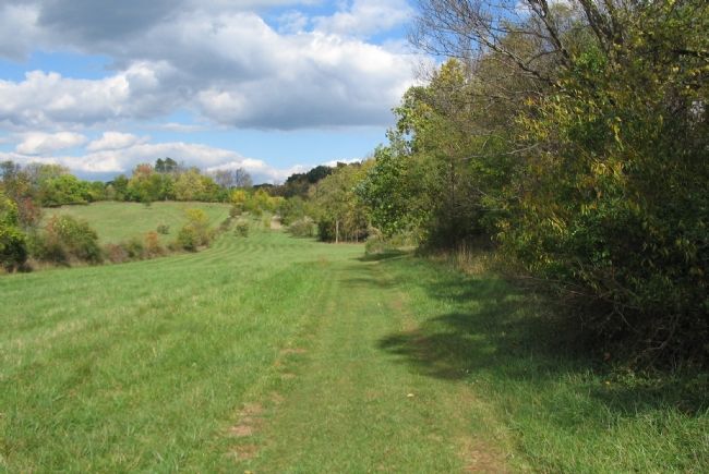
From the walking trail between stops three and four, this view is looking north, roughly where the Confederate left flank stood. To the right side of the photo is a, non-historical, stone wall running north-south but somewhat bracketing the western edge of the battle area. To the distance beyond the high ground and trees is Cedar Creek Grade (CR 622) and the direction from which Tyler's Brigade advanced.
Regarding The Advance of Tyler’s Brigade. This is one of seven battlefield interpretive markers at Rose Hill. See the related markers section below for a listing of the walking tour, or the Kernstown Battles Virtual Tour by Markers in the links section for a driving tour.
Related marker. Click here for another marker that is related to this marker. This marker has been replaced by the linked marker.
Also see . . .
1. Rose Hill Park. Museum of the Shenandoah website entry (Submitted on November 12, 2007, by Craig Swain of Leesburg, Virginia.)
2. Battle of First Kernstown Summary. The action around Rose Hill is discussed in phase three of this National Parks Service battle summary. (Submitted on November 12, 2007, by Craig Swain of Leesburg, Virginia.)
Photographed by Bradley Owen, October 18, 2017
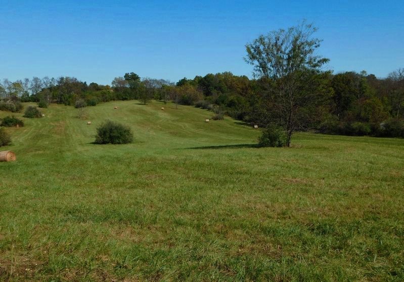
5. The Advance of Tyler’s Brigade
With the new trail created by the Museum of the Shenandoah Valley, the interpretive signage is placed much closer to the events described, such as here where this view shows the ground covered during the Union advance.
Credits. This page was last revised on September 8, 2026. It was originally submitted on November 12, 2007, by Craig Swain of Leesburg, Virginia. This page has been viewed 2,743 times since then and 54 times this year. Last updated on August 15, 2024, by Carl Gordon Moore Jr. of North East, Maryland. Photos: 1, 2, 3, 4. submitted on November 12, 2007, by Craig Swain of Leesburg, Virginia. 5. submitted on April 5, 2021, by Bradley Owen of Morgantown, West Virginia. • Devry Becker Jones was the editor who published this page.
