Saluda in Middlesex County, Virginia — The American South (Mid-Atlantic)
Christ Church
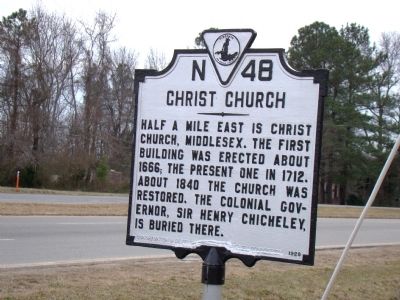
Photographed by J. J. Prats, January 16, 2010
1. Christ Church Marker
Erected 1929 by Conservation & Development Commission. (Marker Number N-48.)
Topics and series. This historical marker is listed in these topic lists: Cemeteries & Burial Sites • Colonial Era • Religion & Religious Structures. In addition, it is included in the Virginia Department of Historic Resources (DHR) series list. A significant historical year for this entry is 1666.
Location. This marker has been replaced by another marker nearby. It was located near 37° 36.083′ N, 76° 34′ W. Marker was in Saluda, Virginia, in Middlesex County. It was at the intersection of General Puller Highway (Virginia Route 33) and Urbanna Road ( Route 227), on the left when traveling east on General Puller Highway. Touch for map. Marker was in this post office area: Saluda VA 23149, United States of America. Touch for directions.

Regionally, this marker was on the Middle Peninsula. It was also in the American South,
this page online
Other nearby markers. At least 8 other markers are within 2 miles of this location, measured as the crow flies: Scottish Factors Store (here, next to this marker); St. Clare Walker High School (approx. 0.3 miles away); Tomb of Puller (approx. 1.2 miles away); a different marker also named Christ Church (approx. 1.2 miles away); Morgan v. Virginia (approx. 1.6 miles away); 1st Lt Beryl R. Newman (approx. 1.6 miles away); Middlesex County Courthouse (approx. 1.6 miles away); Middlesex County Veteran's Memorial (approx. 1.6 miles away). Touch for a list and map of all markers in Saluda.
More about this marker. This marker is now more than a mile west of the church. It was probably moved here
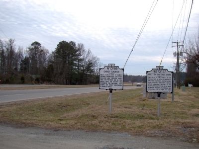
Photographed by J. J. Prats, January 16, 2010
2. Christ Church and Scottish Factors Store Markers
Related marker. Click here for another marker that is related to this marker. Marker has been replaced with the linked marker 1.2 miles northeast, nearer the church itself.
Additional commentary.
1. The grave of Sir Henry Chicheley
From the Parish Register of Christ Church:
"Henry Chicheley Kt. & his Majts Deputy Governor of Virginia Departed this Life on Monday morning Early being 5th of Feb. 1682/3 & was Buried in Christ Church Chancell Middlesex County neare the Communion Table 9th of Feb. 1682/3."
The only extant grave marker inside the church is Edward Thompson's.
— Submitted April 16, 2010, by P. A. Miller of Richmond, California.
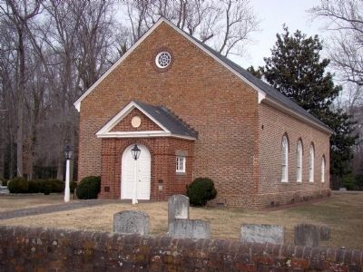
Photographed by J. J. Prats, January 16, 2010
3. Christ Church
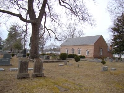
Photographed by J. J. Prats, January 16, 2010
4. Christ Church Churchyard
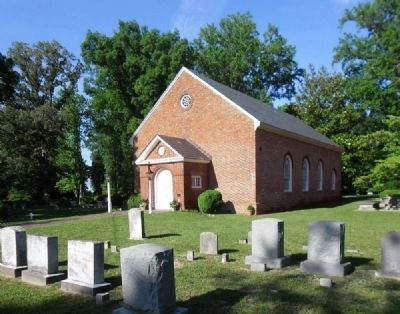
Photographed by Richard W. Dawson, June 16, 2012
5. Christ Church
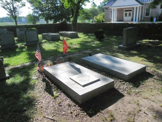
Photographed by Richard W. Dawson, June 16, 2012
6. Christ Church grave of Lt. General Lewis Burwell Puller, USMC.
Lt. General "Chesty" Puller's Grave at Christ Church Parish
Credits. This page was last revised on November 12, 2026. It was originally submitted on January 30, 2010, by J. J. Prats of Powell, Ohio. This page has been viewed 4,217 times since then and 124 times this year. Photos: 1, 2, 3, 4. submitted on January 30, 2010, by J. J. Prats of Powell, Ohio. 5, 6. submitted on June 17, 2012, by Richard W. Dawson of Woodford, Virginia.
