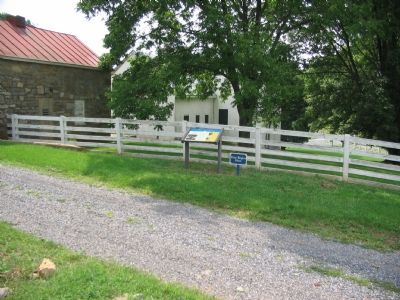
Near Winchester in Frederick County, Virginia — The American South (Mid-Atlantic)
Fight for the High Ground
On the morning of March 23, 1862, Union Colonel Nathan Kimball held "Pritchard's Hill," the high ground on the Pritchard Farm, located on the other side of Route 37 (built in the 1960s). The farm is now preserved by the Kernstown Battlefield Association. "Stonewall" Jackson had been unable to dislodge Northern troops from Pritchard's Hill. Jackson then placed his artillery on even higher ground, Sandy Ridge, the long, wooded ridge on which you are now standing. Jackson's artillery was less than a half-mile from this spot.
Facing the threat of defeat, the Union commander ordered a second assault against the Confederate artillery on Sandy Ridge. At approximately 5:00 p.m., the first of these troops arrived. This caused some of the Southern artillery to withdraw and threatened the Southern right flank behind the stone wall.
(Sidebar):
As we appeared over the brow of a hill, a perfect blizzard met us. The very air seemed to grow heavy with bullets, which striking our men, sounded like the dusting of carpets with rods. We scented what I have never seen in print or heard mentioned - the peculiar odor of lead in violent friction. In front of us, across a little level field, but sixty or seventy-five yards distant, stood a substantial stone wall from behind which Jackson's men were coolly shooting us down....It was a perfect storm of concentrated fire. Already one of our regiments had melted away like snow under the sun. Dead men, with horses here and there, were thick along the line, and I remember thinking as we stood there that this little field came nearer filling my boyish ideas of a battlefield than I ever dreamed of seeing.
Private James Simpson, Company G, 14th Indiana in James H. Simpson, "Battle of Kernstown. How Jackson was Beaten." The National Tribune, February 4, 1882.
(Captions):
This sketch by newspaper artist Alfred R. Waud from the summer of 1862 at Harrisons Landing on the James River in Virginia shows the kinds of artillery that would have been used at Kernstown. - Prints and Photographs Division, Library of Congress
Confederate mapmaker Jedediah Hotchkiss sketched this terrain map of Sandy Ridge, site of a portion of the First Battle of Kernstown, in October 1862. - Hotchkiss Map Collection, Geography and Map Division, Library of Congress
Erected by Museum of the Shenandoah Valley.
Topics. This historical marker is listed in this topic list: War, US Civil. A significant historical date for this entry is February 4, 1882.
Location. 39° 9.073′ N, 78° 12.869′ W. Marker is near Winchester, Virginia, in Frederick County. It can be reached from Jones Road (Virginia Route 621) 0.4 miles south of Cedar Creek Grade ( Route 622), on the left when traveling south. Marker is located on the Main Loop Trail in Rose Hill Park. Touch for map. Marker is at or near this postal address: 1871 Jones Road, Winchester VA 22602, United States of America. Touch for directions.
Regionally, this marker is in Virginia’s Shenandoah Valley. It is also in the American South, specifically in the Upper South, and in the Mid-Atlantic. Globally, it is in North America, the Western Hemisphere, the Western World, and the Anglosphere. Historically, it finds itself in what was once the territory of the Mississippian Culture, one of the original Thirteen Colonies, one of the Confederate States of America, and the Antebellum South.
Other nearby markers. At least 8 other markers are within walking distance of this marker: The Order For Retreat (about 300 feet away, measured in a direct line); The Defense of the Stone Wall (about 400 feet away); The Advance of Tyler's Brigade (about 600 feet away); a different marker also named Northern Victory, Southern Defeat (approx. 0.2 miles away); War In The Backyard (approx. 0.3 miles away); Rose Hill (approx. 0.3 miles away); Caring For the Wounded and Dead (approx. 0.3 miles away); The First Battle Of Kernstown (approx. 0.3 miles away). Touch for a list and map of all markers in Winchester.
Other markers no longer nearby. Northern Victory, Southern Defeat (was about 800 feet away but has been replaced with another marker now near it); The Order for Retreat (was approx. 0.2 miles away but has been replaced with another marker now near it); a different marker also named The Defense of the Stone Wall (was approx. 0.2 miles away but has been replaced with another marker now near it); a different marker also named Fight for the High Ground (was approx. 0.2 miles away but has been replaced with another marker now near it); a different marker also named The Advance of Tylers Brigade (was approx. Ό mile away but has been replaced with another marker now near it); How To See the Battlefield (was approx. 0.3 miles away but has been permanently removed); War in the Backyard (was approx. 0.3 miles away but has been permanently removed).
Related marker. Click here for another marker that is related to this marker. This marker has replaced the linked marker.
Credits. This page was last revised on September 10, 2026. It was originally submitted on September 10, 2026, by Bradley Owen of Morgantown, West Virginia. This page has been viewed 2 times since then. Photos: 1, 2. submitted on September 10, 2026, by Bradley Owen of Morgantown, West Virginia.