
Near Lisco in Morrill County, Nebraska — The American Midwest (Upper Plains)
Narcissa Whitman
Photographed by Christopher Light, June 17, 2007
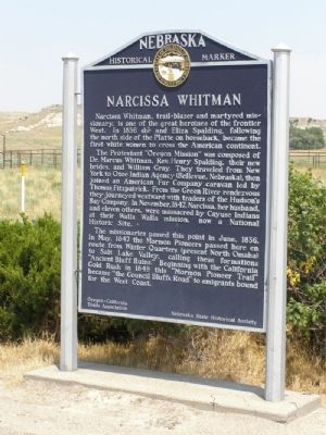
1. Narcissa Whitman Marker
Narcissa Whitman, trail-blazer and martyred missionary, is one of the great heroines of the frontier West. In 1836 she and Eliza Spalding, following the north side of the Platte on horseback, became the first white women to cross the American continent.
The Protestant “Oregon Mission” was composed of Dr. Marcus Whitman, Rev. Henry Spalding, their new brides, and William Gray. They traveled from New York to Otoe Indian Agency (Bellevue, Nebraska), then joined an American Fur Company caravan led by Thomas Fitzpatrick. From the Green River rendezvous they journeyed westward with traders of the Hudson’s Bay Company. In November, 1847, Narcissa, her husband, and eleven others, were massacred by Cayuse Indians at their Walla Walla mission, now a National Historic Site.
The missionaries passed this point in June 1836. In May, 1847 the Mormon Pioneers passed here en route from Winter Quarters (present North Omaha) to Salt Lake Valley, calling these formations “Ancient Bluff Ruins.” Beginning with the California Gold Rush in 1849 this “Mormon Pioneer Trail” became “the Council Bluffs Road” to emigrants bound for the West
this page online
Erected by Oregon-California Trails Association and Nebraska State Historical Society. (Marker Number 295.)
Topics and series. This historical marker is listed in these topic lists: Roads & Vehicles • Settlements & Settlers • Wars, US Indian. In addition, it is included in the California Trail, the Mormon Pioneer Trail, and the Nebraska State Historical Society series lists. A significant historical month for this entry is May 1847.
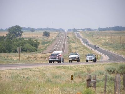
Location. 41° 33.408′ N, 102° 43.848′ W. Marker is near Lisco, Nebraska, in Morrill County. It is on U.S. 26 7 miles west of Lisco. The road is straight and wide open. Keep you eye out for the pull off on the north side of the road. There are no buildings, bluffs, roads or other objects to serve as a guide. Touch for map. Marker is in this post office area: Broadwater NE 69125, United States of America. Touch for directions.

Regionally, this marker is in the Nebraska Panhandle. It is also in the American Midwest, in the Corn Belt, on the prairies, on the Great Plains, and specifically on the High Plains. Globally, it is in North America, the Western Hemisphere, the Western World,
Photographed by Christopher Light, July 17, 2007
2. The Mormon Trail preceded US 26 and the Trans-continental Rails lines westward
Other nearby markers. At least 2 other markers are within 7 miles of this marker, measured as the crow flies: Imaginary Characters…. (approx. 5 miles away); The Mormon Pioneer Trail / The Rapture of Spring (approx. 7 miles away).
Related marker. Click here for another marker that is related to this marker.
Photographed by Christopher Light, July 17, 2007
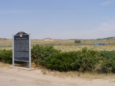
3. "Ancient Bluff Ruins" are in the background
This is open country. The only trees exist right along the river. To the north and south, the land stretches out in rolling plains, until reaching the edge of the valley, where low bluffs reside.
Credits. This page was last revised on February 14, 2026. It was originally submitted on October 9, 2007, by Christopher Light of Valparaiso, Indiana. This page has been viewed 7,665 times since then and 358 times this year. Last updated on May 14, 2023, by Jeff Leichsenring of Garland, Texas. Photos: 1, 2, 3. submitted on October 9, 2007, by Christopher Light of Valparaiso, Indiana. • J. Makali Bruton was the editor who published this page.
