5 entries match your criteria.
Historical Markers in Fraser-Fort George, British Columbia
By B.C. Ministry of Transportation and Infrastructure via Flickr (CC BY-NC-ND 2.0), July 5, 2018
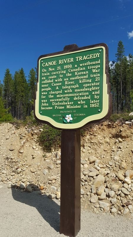
Canoe River Tragedy Marker
| On Southern Yellowhead Highway (Provincial Highway 5) 2.4 kilometers south of Bear Road, on the left when traveling south. |
| Near Yellowhead Highway (Provincial Highway 16) at British Columbia-Alberta boundary line, on the right when traveling west. |
| On Yellowhead Highway (Provincial Highway 16) 24.8 kilometers west of Icefields Parkway (Provincial Highway 93), on the right when traveling west. |
| Near Viewpoint Road, 0.2 kilometers east of Kinney Lake Road, on the left when traveling east. |
| On Caine Drive, 0.5 kilometers from Connaught Drive. |
May. 27, 2024