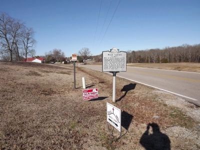
On Life Road (Tennessee Route 200) at Mills Darden Cemetery Road, on the right when traveling west on Life Road.
Born in North Carolina in 1799, Darden settled in Henderson County about 1830. He was an innkeeper and farmer, and physically one of the heaviest men ever to live in the world. At the time of his death, Darden weighed in excess of 1,000 pounds. He . . . — — Map (db m81885) HM
Near Church Road 0.4 miles south of South Tool Drive (Texas Highway 274), on the left when traveling south.
A native of North Carolina, Durham Avant came to Texas in 1834 with his wife, Susan (Winsett), and after a time they settled in present day Henderson County. Avant served as a Texas Ranger and in 1850 helped survey and determine a central location . . . — — Map (db m309684) HM
On Yates Avenue north of Old U.S. 70, on the left when traveling north. Reported permanently removed.
(preface) On March 24, 1865, Union Gen. George Stoneman led 6,000 cavalrymen from Tennessee into southwestern Virginia and western North Carolina to disrupt the Confederate supply line by destroying sections of the Virginia and . . . — — Map (db m284170) HM
On Farm to Market Road 1616 at County Road 3714, on the left when traveling north on Road 1616.
James Madison Shelby (1814-1889), a native of North Carolina, moved with his large family from Alabama to Texas in the 1870s. They first lived in Smith County, then moved to southeastern Henderson County. There they established a Presbyterian church . . . — — Map (db m247185) HM
On County Road 3405, on the right when traveling south.
Rock Hill Cemetery has served this area since the late 1800s. It is located on land granted to pioneer Alexander J. Clayton, who migrated here from Alabama with his wife, Martha (Carver), and his children in 1854. Clayton, who was born in North . . . — — Map (db m31618) HM
On Coxe Avenue at Buxton Avenue, on the right when traveling north on Coxe Avenue.
Prior to integration, Black entrepreneurs and civic leaders created social and economic opportunities for Black communities. Spanish-American War veteran Edward Walton "E.W." Pearson and his wife Annis Bradshaw Pearson established a legacy of Black . . . — — Map (db m282909) HM
On County Road 3901 0.5 miles west of County Road 3900.
North Carolina native Eber Meredith, his wife Caroline (Ross), and their four children moved to this area of Henderson County in the 1850s. Eber Meredith bought 320 acres of land in 1859 and purchased an additional 160 acres four years later. . . . — — Map (db m310435) HM
Near Tennessee Route 22 0.6 miles north of Interstate 40, on the right when traveling north.
This area was named for the Parker farm whose residence was located just south of here. John M. Parker, both a practicing physician and a Baptist preacher, was known as both Doctor and Reverend Parker. His farm straddled the intersection of . . . — — Map (db m72241) HM
On Rutledge Drive (County Route 1166) 0.1 miles south of Kalimar Heights, on the left when traveling south.
Built on the site and foundation of
Kuykendall's Tavern circa 1800 on the Old Buncombe Pike
This site protected by
Historic Flat Rock, Inc. — — Map (db m283164) HM
On North Main Street, on the right when traveling north.
(Lower Plaque)
Built by Col. Valentine Ripley, early
businessman, this is one of the first
brick structures in Hendersonville.
Early uses were a general store,
post office and Confederate
commissary under Major Noe.
M.M. Shepherd . . . — — Map (db m34553) HM
Thin black lines indicate changes in relevance. Between each pair of lines entries are ordered geographically but all have the same relevance.
* Inflectional forms of words are their plurals, singulars, and possessives as well as gramatical tenses and similar variations.