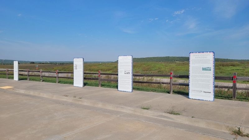
On Bartlesville Road (U.S. 60) at County Road 2809, on the right when traveling east on Bartlesville Road.
Osage County was once a part of the vast homelands of the roaming Osage tribe, but in the early 1800's the land was given to the Cherokee tribe by the American government. In the late 1800's when the Osage tribe relocated from Kansas to Oklahoma, . . . — — Map (db m284734) HM
On Katy Trail west of County Highway BB, on the right when traveling west.
This border area between the Ozarks and Osage Plains once belonged to the Osage nation. Osage lands included southern Missouri, eastern Kansas, and northern Arkansas and Oklahoma.
The Osage maintained their stronghold for several centuries, . . . — — Map (db m272498) HM
On Wornall Road, on the right when traveling south.
English Side
A Frenchman, Pierre Esprit Radisson, wrote in 1659 of a nation” of extraordinary height and bigness” (the Osage) living up the Missouri River. Marquette and Joliet’s 1674 maps show the village of the Osage, and some of . . . — — Map (db m86416) HM
On Lynn Ave at East Main Street (U.S. 60), on the left when traveling south on Lynn Ave.
By 1760 the Osage of Missouri had increased their range to include present day Osage County. In 1835 the area was included in the "perpetual outlet west" guaranteed to the Cherokee Nation under the Treaty of New Echota. In 1870, under the Cherokee . . . — — Map (db m284711) HM
On Bartlesville Road (U.S. 60) at County Road 2809 on Bartlesville Road.
Because of its wealth and location, the Osage Hills became an unwilling host to many outlaw gangs in the 1800's.
This land was an easy refuge for villains and outlaws because of its isolation and rugged terrain. It was far from Fort Smith, . . . — — Map (db m284736) HM
On East Main Srteet (U.S. 60) at Lynn Avenue, on the left when traveling west on East Main Srteet.
The legacy of oil and the Osages is one of the most intriguing facts of the oil industry in America.
On March 16, 1896, the first oil and gas lease was obtained covering all the Osage Reservation, and on October 28, 1897 the first producing . . . — — Map (db m55652) HM
On East Main Street (U.S. 60) at Lynn Avenue (U.S. 60), on the left when traveling west on East Main Street.
In memory and dedication to those whose foresight, frustrations and sacrifices have helped the Osage Tribe to preserve its identity [sp], development and culture.
1865 - The Osages agreed to the sale of their Kansas lands.
1871 — . . . — — Map (db m55653) HM
On North Dewey Avenue 0.1 miles 1st Drive, on the left when traveling north.
The Hulah Santa Fe depot owes its origin to the lush bluestem cattle grazing grass in much of Osage County, Oklahoma. Cattle owners would fatten cattle on this grass before taking them to markets.
The Santa Fe railroad in 1918 began building a . . . — — Map (db m284522) HM
On East Main Street (U.S. 60) at Lynn Avenue, on the left when traveling west on East Main Street.
Pawhuska, Oklahoma county seat of Osage County
was named for well known Osage Chief
Pa-Hus-Ka whose name means White Hair
The Post Office was established May 4, 1876
A community who embraces with pride the
reflections of our past and . . . — — Map (db m55651) HM
On Kihekah Avenue at 7th Street, on the left when traveling north on Kihekah Avenue.
Vernon Whiting, builder of the "Historical Whiting Apartments" in the 1920's, was born in 1870 in Ogdensburg, New York. His family later moved to Seward, Nebraska. Vernon graduated high school there in Seward, then took a business course at . . . — — Map (db m81152) HM
Thin black lines indicate changes in relevance. Between each pair of lines entries are ordered geographically but all have the same relevance.
* Inflectional forms of words are their plurals, singulars, and possessives as well as gramatical tenses and similar variations.