THE HISTORICAL
MARKER DATABASE
“Bite-Size Bits of Local, National, and Global History”


2 entries match your criteria.  


Historical Markers in Brent
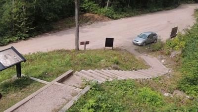
 
By Kevin Westell, August 28, 2017
Brent Crater Hiking Trail - Parking Lot
1 ► Ontario, Nipissing District, Brent — Brent Crater —

First recognized in 1951 from aerial photographs, the crater is a circular depression about two miles in diameter formed in Precambrian crystalline rocks. Geophysical and diamond drilling investigations show that the crater has a present depth . . . — — Map (db m284109) HM
2 ► Ontario, Nipissing District, Brent — Brent Crater: The Discovery — La découverte —
Early in 1951, John A. Roberts (president of Spartan Air Services in Ottawa) was looking at high-altitude aerial photographs taken by his company north of Brent and noticed an almost perfectly circular feature about 3 kilometres . . . — — Map (db m284111) HM


CeraNet Cloud Computing sponsors the Historical Marker Database.
This website earns income from purchases you make after using our links to Amazon.com. We appreciate your support.
Paid Advertisement
Nov. 11, 2026