George Fox 1624 – 1691 was imprisoned in this castle in 1656, for eight months. With other Quakers he suffered under unspeakable conditions in Dooms-Dale
“There was never under any imprisonment that I was in but it was for the . . . — — Map (db m124010) HM
To the
Immortal Honour
of
Those from this Town
who gave their Lives
for King & Country
in the Great Wars
1914-1918
1939-1945
W.H. Adams · S. Bartlett · D.B. Bennett · T. Bennett · C. Bickle · G.T. Brendon · A.J. Brent · J. . . . — — Map (db m124177) WM
Moote Hall
c.13th century
The castle, a symbol of law and order
was used as a centre of justice.
This building was used by the assizes
(travelling courts) and also for
administrative purposes. — — Map (db m124128) HM
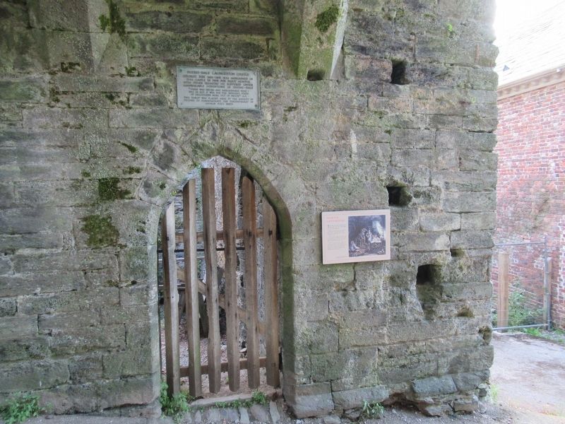
This was the main entrance into the castle from the town until the late 12th century.
Originally, there was a deep ditch around the castle crossed by a fortified bridge. This was destroyed when nearby Eagle House was built in the 18th century. . . . — — Map (db m124009) HM
Shell Keep
c.12th century
This circular stone wall had a wall walk on the top designed principally for use as a fighting platform. The High Tower was built inside this wall in the13th century and the gap spanned with a platform. (Note the joist . . . — — Map (db m124180) HM
In the Middle Ages this gatehouse led out to the Earl's private deer park. The entrance passage continued out across the castle ditch, over a fortified bridge to where the Guildhall now stands.
Four square holes for the timber decking can be . . . — — Map (db m124176) HM
Throughout the Middle Ages the courtyard was packed full of buildings providing accommodation for the Lord and his followers.
There were also service buildings: a survey carried out in 1337 lists a chapel, stable, gaol, hall and various . . . — — Map (db m124126) HM
The development of the Castle
The first castle was built in the years immediately after the Norman Conquest — a military outpost in hostile country.
The original timber defences were gradually replaced in stone and by the 12th century . . . — — Map (db m124178) HM
The Earl's Chamber
You are standing in the lobby which led into the Earl's chamber in front of you.
Behind you another door led out onto the flat roof which, in the 13th century, covered the space between the high tower and surrounding walls. . . . — — Map (db m124203) HM
The Gate
There was a strongly defended gate here in the 13th century. The slot for the portcullis and the deep socket for the stout timber beams which secured the door can be seen in the wall behind you.
To your right, steps within the . . . — — Map (db m124206) HM
The Keep
In the 13th century, the building high on the mound in front of you provided a lordly reception suite where the Earl could entertain on special occasions.
The approach was deliberately formal and designed to impress. Anyone wishing . . . — — Map (db m124179) HM
The Landscape
From the top of this high tower it is easy to see why the Normans built their castle here at Launceston. Not only does the castle dominate the surrounding countryside but it also controlled the main road into Cornwall at the . . . — — Map (db m124205) HM
The Trafalgar Way
Launceston - 4th Post-Horse Change
On Monday, 21st October 1805 the Royal Navy decisively defeated the Combined Fleet of France and Spain off Cape Trafalgar south of Cadiz. This victory permanently removed the threat . . . — — Map (db m122161) HM