On Church Street at Ontario Highway 2, on the right when traveling south on Church Street.
Described as a writer "having a mission", this novelist, poet and historian authored ten books. Born in Crysler, she was the daughter of an Anglican priest, The Venerable Archdeacon Rupert J. Dumbrille and his wife. She lived in many Eastern Ontario . . . — — Map (db m89998) HM
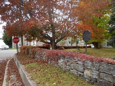
On County Highway 2 at Church Street (County Highway 2), on the left when traveling east on County Highway 2.
Pax Alma Redit
DOUGLAS RUPERT DUMBRILLE
1889-1974
A Canadian pioneer in early Hollywood, this character actor was born in
Hamilton, Ontario. He frequently vacationed here at "Sprucelawn,” his
father's birthplace.
Sometimes . . . — — Map (db m204922) HM
On Provincial Highway 2 near Church Street, on the right when traveling east.
Built as a house in the 1850s, this sturdy stone building was altered in 1877 by John Dumbrille, when he relocated his general store from across the street in front of his residence "Sprucelawn". In 1879 he was appointed Maitland's postmaster and . . . — — Map (db m89979) HM
On Provincial Highway 2, 3.6 kilometers west of Blue Church Road, on the right when traveling west. Reported missing.
Construction of Homewood was begun in 1800 by Dr. Solomon Jones, a prominent Loyalist, local officeholder and early resident of this region. With its balanced five-bay façade, centre hallway plan and classical detailing, it reflects the influence of . . . — — Map (db m205243) HM
On Provincial Highway 2 west of Church Street, on the right when traveling west.
Born in Lachute, Québec, MacDowell moved to Maitland in 1897. He attended local schools and graduated from the University of Toronto in 1915. During World War I, he enlisted, on January 9, 1915, in the 38th Battalion, C.E.F. On April 9, 1917, during . . . — — Map (db m89999) HM
On Provincial Highway 2, 0.1 kilometers west of Maitland Road, on the right when traveling west.
English text: The barques "Iroquoise" and "Outaouaise", the last French ships of war that navigated Lake Ontario, were built on this point, then called Pointe Au Baril. On 17th August, 1760, the Outaouaise, commanded by Captain La Broquerie, . . . — — Map (db m87011) HM
On Church Street, 0.3 kilometers north of Ontario Highway 2, on the left when traveling north.
Among Augusta Township's earliest settlers were a number of Anglican Loyalists who, by 1785, we're holding services in private houses. The first resident missionary, the Reverend John Bethune, was appointed to this area in 1814. Reverend Robert . . . — — Map (db m90002) HM
On Church Street, 0.1 kilometers north of Ontario Highway 2, on the left when traveling north.
In a building on property contiguous to this site, St. James Lodge No. 74 (originally No. 40) was founded 9 February 1857. The Christian Order of Masonry, then known as the Sovereign Grand Conclave of England and Wales was instituted here 6 March . . . — — Map (db m90000) HM
On Provincial Highway 2 west of Church Street, on the right when traveling east.
In this vicinity, the site of a shipyard used during both the late French and early British periods, a village plot was laid out in 1824 for Jehiel and Ziba Phillips. Adjacent to it George Longley, a recent English emigrant, acquired an estate on . . . — — Map (db m89996) HM