Marker Logo HMdb.org THE HISTORICAL
MARKER DATABASE
“Bite-Size Bits of Local, National, and Global History”


After filtering for Newfoundland and Labrador, 6 entries match your criteria.  


Historical Markers in Placentia, Newfoundland and Labrador

 
Outer Defenses image, Touch for more information
By Barry Swackhamer, June 21, 2014
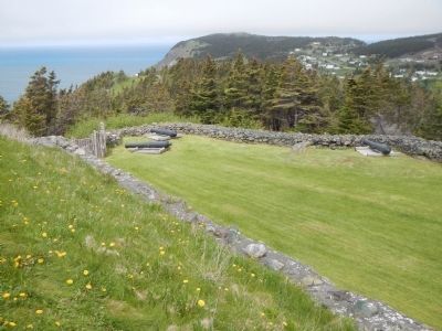
Outer Defenses
1 Newfoundland and Labrador, Avalon Peninsula, Newfoundland, Placentia — (Fort Royal)Outer Defences / Défenses avancées
Near Castle Hill Road.
2 Newfoundland and Labrador, Avalon Peninsula, Newfoundland, Placentia — Castle Hill
On Castle Hill Road close to Route 100 South.
3 Newfoundland and Labrador, Avalon Peninsula, Newfoundland, Placentia — Castle Hill
On Castle Hill Road close to Route 100 South.
4 Newfoundland and Labrador, Avalon Peninsula, Newfoundland, Placentia — Fort Frederick
On Main Street (Route 100 South) close to Orcan Drive, on the left when traveling south.
5 Newfoundland and Labrador, Avalon Peninsula, Newfoundland, Placentia — Fort Royal (Plaisance)le fort Royal
Near Castle Hill Road.
6 Newfoundland and Labrador, Avalon Peninsula, Newfoundland, Placentia — Port Royal and Castle GravesPort Royal et Castle Graves
Near Castle Hill Road.
 
 
CeraNet Cloud Computing sponsors the Historical Marker Database.
This website earns income from purchases you make after using our links to Amazon.com. We appreciate your support.
Paid Advertisement
May. 25, 2024