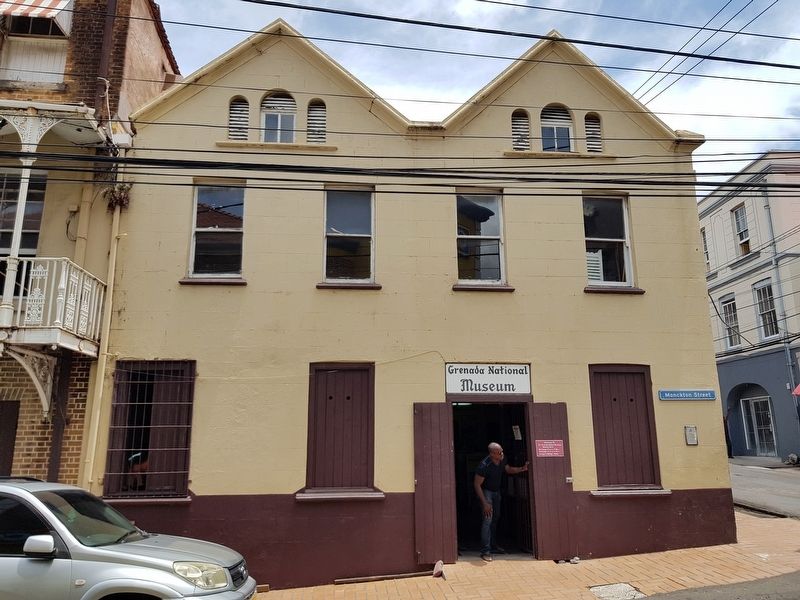
On Monckton Street at Young Street, on the left when traveling north on Monckton Street.
While the museum’s structure is, indeed, an historic artifact, the museum’s collection offers a variety of objects emphasizing the island’s past. Relics from native Indian populations provide a glimpse into early history while flora and fauna . . . — — Map (db m135193) HM
On Wharf Road just west of Tanteen Road, on the right when traveling west.
This corner stone was laid by the President of the Grenada Seamen and Waterfront Workers’ Union Bro. Arthur Ramsay on the occasion of the 25th Anniversary of the Union on the 1st. May 1977. — — Map (db m135182) HM
On Market Hill just east of Grenville Street, on the left when traveling east.
Historic Sedan Chair Portico This portico is the actual front entrance of this building for sedan chairs. In the 19th century, during early British colonial rule in Grenada, the sedan chair was a major mode of transportation used by the free . . . — — Map (db m135206) HM
On H.A. Blaize Street just east of Bain Alley, on the right when traveling east.
Marryshow House This structure was once the home of T. Albert Marryshow, better known as The “Father of the Federation.” This West Indian statesman promoted the formation of one nation from all of the West Indies. Aside from its . . . — — Map (db m135227) HM
On Lagoon Road just east of Paddock Road, on the left when traveling north.
Port Louis (1650) Grenada’s First Town On June 20th 1650 the French colonist led by Du Parquet, Governor of Martinique landed in this area and set up the first town which was called Port Louis. Project by: Kids Learning Center Sponsored by: . . . — — Map (db m135180) HM
On Church Street at St. John's Street, on the right when traveling north on Church Street.
Roman Catholic Cathedral Located on Upper Church Street, this church reflects several dates of construction. The tower, constructed in 1818, is the oldest part of the building. The remaining portion was built in 1884 on the site of an 1804 . . . — — Map (db m135225) HM
On Market Hill just east of Grenville Street, on the left when traveling east.
Sedan Porches These porches were popular in the seventeenth and eighteenth centuries when sedan chairs were a form of transportation. The porches, open on two sides, would shelter passengers from bad weather when they were embarking or . . . — — Map (db m135205) HM
On Grand Etang Road just south of Young Street, on the left when traveling south.
St. Andrew’s Presbyterian Kirk Popularly known as the Scots’ Kirk, this structure sits at the end of the Church Street. It was constructed in 1831 with assistance from the Freemasons. Two features for which the church is well known are its . . . — — Map (db m135203) HM
Although not located on Church Street, this structure has the distinction of being the oldest original church building in St. George's parish. It was constructed in 1820 and is still in use today. This brick structure, with simple brick buttresses . . . — — Map (db m94081) HM