Marker Logo HMdb.org THE HISTORICAL
MARKER DATABASE
“Bite-Size Bits of Local, National, and Global History”


5 entries match your criteria.  


Related Historical Markers

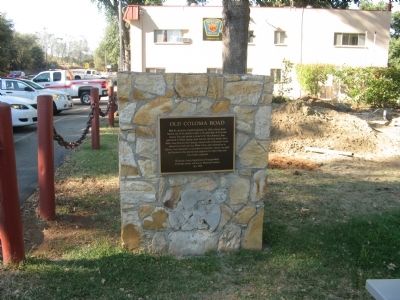
- The route from Sutter’s Fort to Sutter’s Mill.
 
Old Coloma Road Marker image, Touch for more information
By Syd Whittle, September 8, 2008
Old Coloma Road Marker
SHOWN IN SOURCE-SPECIFIED ORDER
1 California, El Dorado County, Rescue — Old Coloma Road
On Green Valley Road at Deer Valley Road, on the left when traveling east on Green Valley Road.
2 California, El Dorado County, Rescue — 747 — The Coloma Road
On Green Valley Road at Deer Valley Road, on the right when traveling east on Green Valley Road.
3 California, El Dorado County, Coloma — 530 — Sutter’s Mill Site
Near Coloma Road (California Route 49) north of Mt Murply Road, on the right when traveling north.
4 California, Sacramento County, Gold River — 746 — The Coloma Road
5 California, Sacramento County, Sacramento, Midtown — 745 — The Coloma Road
On L Street at 28th Street, on the right when traveling west on L Street.


CeraNet Cloud Computing sponsors the Historical Marker Database.
This website earns income from purchases you make after using our links to Amazon.com. We appreciate your support.
Paid Advertisement
May. 21, 2024