7 entries match your criteria.
Related Historical Markers
Fort Matanzas National Monument
By Tim Fillmon, April 8, 2016
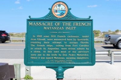
Newly restored Massacre of the French Marker
SHOWN IN SOURCE-SPECIFIED ORDER
| On North Ocean Boulevard (State Road 1A), on the right when traveling south. |
| | In 1565 some 300 French castaways, under Jean Ribault, were massacred here by Spaniards, crushing their attempt to occupy Florida. The French ships, sailing from Fort Caroline to attack St. Augustine, were driven ashore by a storm. At this inlet . . . — — Map (db m46145) HM |
| Near A1A Scenic and Historic Coastal Byway (State Road A1A) 4 miles south of State Road 206, on the right when traveling south. |
| | The Spanish built Fort Matanzas in 1740-42 to control Matanzas inlet, the "back door" to St. Augustine.
Much earlier, in 1565, Spain had bloodily crushed here a French challenge to her control of Florida by killing the remnants of a French colony . . . — — Map (db m127607) HM |
| Near A1A Scenic and Historic Coastal Byway (State Highway A1A) 4 miles south of State Highway 206, on the right when traveling south. |
| | Closing the Door (English)
The Spanish built Fort Matanzas to protect the southern approach to St. Augustine. Spanish ships from Cuba used this waterway to resupply the town during the 1740 British siege. After the siege, they built this . . . — — Map (db m127495) HM |
| Near A1A Scenic and Historic Coastal Byway (State Highway A1A) 4 miles south of State Highway 206, on the right when traveling south. |
| | Massacre by Menendez of Ribault
and his men September 1565 — — Map (db m127496) HM |
| Near A1A Scenic and Historic Coastal Byway (State Highway A1A) 4 miles south of State Highway 206, on the right when traveling south. |
| | Old World Showdown (English)
One of the first colonial conflicts between European nations happened near here in 1565. Spain had already claimed Florida when France established Fort Caroline near present-day Jacksonville. This . . . — — Map (db m127497) HM |
| Near A1A Scenic and Historic Coastal Byway (State Highway A1A) 4 miles south of State Highway 206, on the right when traveling south. |
| | Crumbling Coquina
Fort Matanzas was built using coquina, a local limestone. This porous limestone is made from millions of seashells pressed together for thousands of years. The Spanish coated the fort walls with plaster made . . . — — Map (db m127498) HM |
| Near A1A Scenic and Historic Coastal Byway (State Road A1A) 4 miles south of State Road 206, on the right when traveling south. |
| | The Spanish built Fort Matanzas in 1740-42 to control Matanzas inlet, the "back door" to St. Augustine.
Much earlier, in 1565, Spain had bloodily crushed here a French challenge to her control of Florida by killing the remnants of a French colony . . . — — Map (db m127607) HM |
Apr. 30, 2024