7 entries match your criteria.
Related Historical Markers
Door County Coastal Byway
Courtesy of the Sister Bay Historical Society
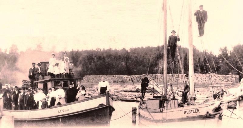
Marker detail: Employees of Roeser posed for this 1904 photo on company boats
SHOWN IN SOURCE-SPECIFIED ORDER
| On Mill Road (State Highway 42) at Mill Road, on the right when traveling west on Mill Road. |
| On Mill Road (State Highway 42) at Bay Shore Drive, on the right when traveling west on Mill Road. |
| On Sunnyside Lane (State Highway 42) 0.1 miles north of Porcupine Bay Road, on the left when traveling north. |
| On Sunnyside Lane (State Highway 42) 0.1 miles north of Porcupine Bay Road, on the left when traveling north. |
| On Horseshoe Bay Road at Egg Harbor Road (State Highway 42), on the right when traveling south on Horseshoe Bay Road. |
| On State Highway 42 at Forest Road, on the right when traveling north on State Highway 42. |
| On State Highway 42 at Forest Road, on the right when traveling north on State Highway 42. |
May. 8, 2024