3 entries match your criteria.
Related Historical Markers
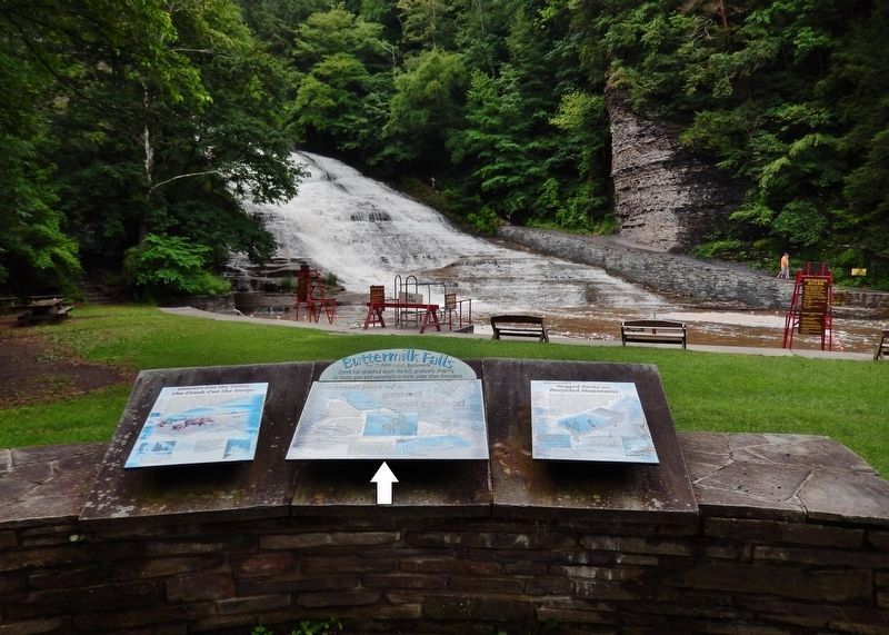
Buttermilk Falls
By Cosmos Mariner, July 14, 2017
Buttermilk Falls Marker
SHOWN IN SOURCE-SPECIFIED ORDER
| Near East Buttermilk Falls Road, 0.1 miles east of Elmira Road (New York State Route 96) when traveling east. |
| | For 12,000 years, Buttermilk Creek has splashed down the hill, gradually shaping its lovely glen and waterfalls in the rocks older than dinosaurs.
The water of Buttermilk Falls begins its journey six miles south of here at Jennings . . . — — Map (db m146541) HM |
| Near East Buttermilk Falls Road, 0.1 miles east of Elmira Road (New York State Route 96) when traveling east. |
| | Several times over the past two million years, vast Ice Age glaciers plowed south from Canada. The glaciers dug out steep-sided valleys that now hold Cayuga Lake and the other Finger Lakes. Since the most recent glacier melted away12,000 years ago, . . . — — Map (db m146542) HM |
| Near East Buttermilk Falls Road, 0.1 miles east of Elmira Road (New York State Route 96) when traveling east. |
| | The layers of rock in the cliffs and the waterfall were once mud, silt and sand on the bottom of a sea that covered much of what is now New York State. Rivers eroded these sediments from the rocks of an ancient Mountain range in eastern New York and . . . — — Map (db m146543) HM |
May. 21, 2024