15 entries match your criteria.
Related Historical Markers
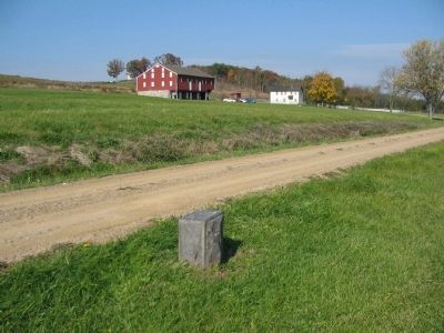
The left wing of the Eleventh Corps Line or Howard Avenue at Gettysburg.
By Craig Swain, November 1, 2008
Position Marker and the McLean Farm
SHOWN IN SOURCE-SPECIFIED ORDER
| On McLean Farm Lane, 0.1 miles north of Mummasburg Road, on the right when traveling north. |
| On Howard Avenue at Mummasburg Road, on the right on Howard Avenue. |
| On Howard Avenue, on the left when traveling east. |
| On Howard Avenue, 0.1 miles east of Mummasburg Road, on the right when traveling east. |
| On Howard Avenue at Mummasburg Road, on the right when traveling east on Howard Avenue. |
| On Howard Avenue, 0.1 miles east of Mummasburg Road, on the right when traveling east. |
| On Howard Avenue, 0.2 miles east of Mummasburg Road, on the right when traveling east. |
| On Howard Avenue, 0.2 miles east of Mummasburg Road, on the right when traveling east. |
| On Howard Avenue, 0.2 miles east of Mummasburg Road, on the right when traveling east. |
| On Howard Avenue, 0.2 miles west of Carlisle Road (Pennsylvania Highway 34), on the right when traveling east. |
| On Howard Avenue, 0.2 miles west of Carlisle Road (Pennsylvania Highway 34), on the right when traveling east. |
| On Howard Avenue, 0.1 miles west of Carlisle Road (Pennsylvania Highway 34), on the right when traveling east. |
| On Howard Avenue, 0.1 miles west of Carlisle Road (Pennsylvania Highway 34), on the right when traveling east. |
| On Howard Avenue at Carlisle Road (Pennsylvania Highway 34), on the right when traveling east on Howard Avenue. |
| On Howard Avenue, 0.1 miles west of Carlisle Road (Pennsylvania Highway 34), on the left when traveling east. |
May. 16, 2024