On North Avenue (Georgia Route 138) at Hynds Springs Road, on the right when traveling west on North Avenue.
Aug. 31, 1864. This immediate area was occupied by the Army of the Tenn. [US], commanded by Gen. O. O. Howard. These troops, Logan’s 15th, Ransom’s 16th & Blair’s 17th corps, marched to this position from Fairburn the previous day; the 15th & . . . — — Map (db m18824) HM
On Tara Boulevard (U.S. 41) at Battle Creek Parkway, on the right when traveling north on Tara Boulevard.
Aug. 31, 1864. The night march of Hardee’s A. C. (followed by Anderson’s div. of S. D. Lee’s) [CS] from East Point & Rough and Ready to Jonesboro, was not without incident. About 3 A. M. the head of Brown’s column encountered Federal pickets at . . . — — Map (db m18175) HM
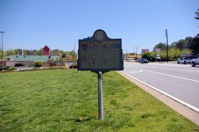
On Fayetteville Road (Georgia Route 54) at North Avenue (Georgia Route 138), on the right when traveling south on Fayetteville Road.
Gen. Hood's move to checkmate the Federal foray at Jonesboro on the one remaining railroad entering Atlanta, resulted in two major engagements August 31 & September 1, 1864. Aug. 31. A concerted attack on the Fed. 15th A. C. between the town & . . . — — Map (db m18288) HM
On Fayetteville Road (Georgia Route 54) at West Mill Road, on the right when traveling south on Fayetteville Road.
Aug. 31, 1864. The three divs. of Hardee’s A. C. [CS] Lowrey’s, Brown’s & Maney’s (under Gen. Cleburne), moved W. from Jonesboro to attack the flank of the intrenched Federal 15th A. C. 400 yds. N. This called for a wheel to the right (or N.) & . . . — — Map (db m18294) HM
On North Main Street (Georgia Route 54) at Stockbridge Road (Georgia Route 138), on the right when traveling south on North Main Street.
Ante-Bellum home of James F. Johnson, attorney, planter, merchant, Confederate officer and noted political figure in mid-nineteenth century Georgia. Johnson introduced the legislation which created Clayton County in 1858 and the bill which . . . — — Map (db m18183) HM
On Jonesboro Road (Georgia Route 54) at Adamson Drive, on the right when traveling south on Jonesboro Road.
Sept. 1, 1864. The area bounded by the McPeak house (N), the Warren house (S), the R. R. (E), & U.S. 41 (W), was the scene of the final pitched battle of the Atlanta Campaign (begun May 7, '64). Hardee’s A. C. [CS], posted in a salient angle at . . . — — Map (db m18185) HM
On Jonesboro Road (Georgia Route 54) 0.2 miles south of Battle Creek Road, on the right when traveling south. Reported missing.
Cited in Official Records of military operations at Jonesboro, 1864; not the one standing in 1958, but one at rear on the old road of which the driveway is a remaining portion. Aug. 31, 1864, Hardee’s A. C. & Anderson’s div. of S. D. Lee’s, marched . . . — — Map (db m59426) HM
On North Main Street (Georgia Route 54) at Stockbridge Road (Georgia Route 138), on the right when traveling south on North Main Street.
Historic Jonesboro, named in honor of Samuel Goode Jones in 1845, was founded in 1823 as Leaksville. Later Clayton County was created by the Act of November 30, 1858 from Fayette and Henry Counties, and Jonesboro became the County Seat. The town . . . — — Map (db m18815) HM
On North Main Street (Georgia Route 54) at Stockbridge Road (Georgia Route 138), on the right when traveling north on North Main Street.
Aug. 31, 1864. When Gen. Hood in Atlanta heard that Federal forces had seized the railroad at Rough and Ready & suspecting an attack from that quarter, he ordered Gen. S. D. Lee’s A. C. [CS] to move back toward Atlanta to support Stewart’s A. C. . . . — — Map (db m18809) HM