Piney Point in St. Mary's County, Maryland — The American Northeast (Mid-Atlantic)
Piney Point Lighthouse
The Potomac Flotilla
Inscription.
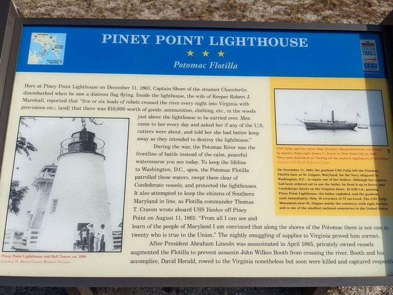
Here at Piney Point Lighthouse on December 11, 1861, Captain Shore of the steamer Chamberlin disembarked when he saw a distress flag flying. Inside the lighthouse, the wife of Keeper Robert J. Marshall, reported that "five or six loads of rebels crossed the river every night into Virginia with provisions etc.; [and] that there was $10,000 worth of goods, ammunition, clothing, etc., in the woods just above the lighthouse to be carried over. Men came to her every day and asked her if any of the U.S. cutters were about, and told her she had better keep away as they intended to destroy the lighthouse."
During the war, the Potomac River was the frontline of battle instead of the calm, peaceful watercourse you see today. To keep the lifeline to Washington, D.C., open, the Potomac Flotilla patrolled these waters, swept them clear of Confederate vessels, and protected the lighthouses. It also attempted to keep the citizens of Southern Maryland in line, as Flotilla commander Thomas T. Craven wrote aboard USS Yankee off Piney Point on August 11, 1861: "From all I can see and learn of the people of Maryland I am convinced that along the shores of the Potomac there is not one in twenty who is true to the Union." The nightly smuggling of supplies to Virginia proved him correct.
After President Abraham Lincoln was assassinated in April 1865, privately owned vessels augmented the Flotilla to prevent assassin John Wilkes booth from crossing the river. Booth and his accomplice, David Herald, rowed to the Virginia nonetheless but soon were killed and captured respectively.
(sidebar)
On November 11, 1864, the gunboat U.S.S. Tulip left the Potomac Flotilla base at St. Inigoes, Maryland, for the Navy shipyard in Washington, D.C., to repair one of her boilers. Although her captain had been ordered not to use the boiler, he fired it up to hurry past Confederate forces on the Virginia shore. At 6:20 P.M., passing Piney Point Lighthouse, the boiler exploded, and the gunboat sank immediately. Only 10 crewmen of 57 survived. The USS Tulip Monument near St. Inigoes marks the cemetery, with eight burials, and is one of the smallest national cemeteries in the United States.
(captions)
Piney Point Lighthouse and Bell Tower, circa 1900 Courtesy St. Mary's County Museum Division
U.S.S. Tulip and her sister ship, Fuchsia (illustrated here), were built by master shipwright James C. Jewitt in New York City in 1862. They were described as "having all the modern appliances of warships. Courtesy U.S. Naval Historical Center.
Erected by Maryland Civil War Trails.
Topics and series. This historical marker is listed in these topic lists: Cemeteries & Burial Sites • War, US Civil • Waterways & Vessels. In addition, it is included in the Maryland Civil War Trails series list. A significant historical date for this entry is December 11, 1861.
Location. 38° 8.154′ N, 76° 31.748′ W. Marker is in Piney Point, Maryland, in St. Mary's County. Marker can be reached from Lighthouse Road (County Route 498) 1.4 miles east of Piney Point Road (County Route 249), on the left when traveling east. Touch for map. Marker is at or near this postal address: 44720 Lighthouse Rd, Piney Point MD 20674, United States of America. Touch for directions.
Other nearby markers. At least 8 other markers are within walking distance of this marker. Potomac River Military Testing (here, next to this marker); Bay Lights (here, next to this marker); Osprey (here, next to this marker); Map of Lower Potomac River and Chesapeake Bay (here, next to this marker); a different marker also named Piney Point Lighthouse (here, next to this marker); The Lighthouse Keeper's Quarters (here, next to this marker); a different marker also named Piney Point Lighthouse (here, next to this marker); Lighthouses of the Chesapeake (within shouting distance of this marker). Touch for a list and map of all markers in Piney Point.
Related marker. Click here for another marker that is related to this marker. Old Marker At This Location also titled "Piney Point Lighthouse".
Credits. This page was last revised on December 24, 2021. It was originally submitted on December 22, 2021, by Sean C Bath of Silver Spring, Maryland. This page has been viewed 181 times since then and 62 times this year. Photo 1. submitted on December 19, 2021, by Sean C Bath of Silver Spring, Maryland. • Bernard Fisher was the editor who published this page.
