On Olivers Shop Road (Maryland Route 232) 1.2 miles south of Leonardtown Road (Maryland Route 5).
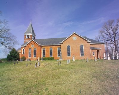
On November 13, 1864, here at St. Mary’s Catholic
Church, Dr. Samuel A. Mudd was introduced to John
Wilkes Booth, the future assassin of President Abraham Lincoln. Booth had come to Charles County to
contact the Confederate underground here and . . . — — Map (db m924) HM
On Brandywine Road (Maryland Route 381) 0.1 miles south of Woodyard Road (Maryland Route 223), on the left when traveling south.
The assassin of Lincoln stopped here at the house of Mrs. Surratt to secure ammunition on the night of April 14, 1865. He rode on to "T.B." and then to Dr. Mudd's who set his broken leg. — — Map (db m3612) HM
On Dr. Samuel Mudd Road (Maryland Route 232) near Poplar Hill Road (Maryland Route 382).
This house was the home of Dr. Samuel Alexander Mudd and his wife, Sarah Frances Dyer. Early on the morning of April 15, 1865, John Wilkes Booth arrived here with a companion, David E. Herold, and asked Mudd to set Booth’s broken leg. Afterward, as . . . — — Map (db m921) HM
On Bel Alton Newton Road at Wills Road, on the right when traveling north on Bel Alton Newton Road.
John Wilkes Booth and David Herold remained hidden from April 16 to 21, 1865 in a nearby pine thicket, while Union troops searched for them. Thomas A. Jones brought them food and the newspapers. — — Map (db m39524) HM
On Bel Alton Newtown Road, on the left when traveling east.
Mid-18th century farm house (with alterations after 1800) was home of Col. Samuel Cox. This southern sympathizer fed and sheltered fugitives John Wilkes Booth and David E. Herold before dawn on Easter Sunday, April 16, 1865 following Booth's . . . — — Map (db m4458) HM
Near Bel Alton Newtown Road, 0.1 miles east of Rich Hill Farm Road, on the right when traveling west.
After leaving Dr. Samuel A. Mudd's house on April 15, 1865, John Wilkes Booth, the assassin of President Abraham Lincoln, and his accomplice David E. Herold avoided Zekiah Swamp and made a wide arc around the village of Bryantown. Unsure of their . . . — — Map (db m129036) HM
On Popes Creek Road, 1.8 miles south of Crain Highway (U.S. 301).
John Wilkes Booth and David Herold set out from here for the Virginia shore during the night of April 21, 1865, in a boat supplied by Thomas A. Jones. — — Map (db m128809) HM
On Dahlgren Road (Virginia Route 206) at Cleydael Boulevard, on the right when traveling north on Dahlgren Road. Reported permanently removed.
This T-shaped house was built in 1859 by Dr. Richard Stuart as a summer residence for his family. On Sunday afternoon, April 23, 1865, John Wilkes Booth and three companions came to this house seeking medical assistance from Dr. Stuart. Suspicious . . . — — Map (db m2925) HM
On U.S. 301, 2.5 miles south of U.S. 17, on the right when traveling north. Reported missing.
This is the Garrett place where John Wilkes Booth, assassin of Lincoln, was cornered by Union soldiers and killed, April 26, 1865. The house stood a short distance from this spot. — — Map (db m1584) HM