4 entries match your criteria.
Related Historical Markers
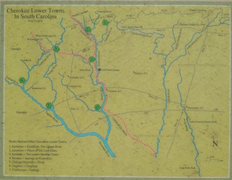
By Tom Bosse, May 14, 2022
Cherokee Lower Towns in South Carolina
SHOWN IN SOURCE-SPECIFIED ORDER
| | The Cherokee in South Carolina Prior to 1776
The Cherokee call themselves Tsalagi or Aniyunwiya which means “Principal People”.
There were no known permanent Native American settlements at this site. The area was a wilderness hunting . . . — — Map (db m198539) HM |
| | Pre 1700 Cedar Falls Environment
• The Piedmont foothills of South Carolina was a frontier landscape. Ancient oak and hickory trees reached for the sun creating a rich canopy that shaded the forest floor.
• The forest was interspersed . . . — — Map (db m198540) HM |
| | Settled in the 1780’s, Fork Shoals was not a typical Southern textile mill village where residents earned their living solely at the mill. The community was primarily agrarian and the people supplemented their farm income by working at the mill. . . . — — Map (db m198572) HM |
| | Cedar Falls 1800’s
The rock shoals at Cedar Falls were used for hundreds of years by Native Americans as a hunting camp site and transportation ford to cross the Reedy River. Due to the elevation change in the river, generating waterpower . . . — — Map (db m198574) HM |
May. 7, 2024