4 entries match your criteria.
Related Historical Markers
Joplin Heritage Trail
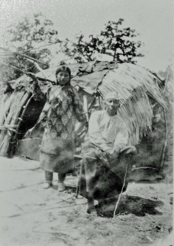
Courtesy Kansas State Historical Society
Osage Couple
SHOWN IN SOURCE-SPECIFIED ORDER
| On Northwest Murphy Boulevard just south of East Pool Street, on the right when traveling north. |
| | Osage Nation in the Joplin Region More than a thousand years ago, the Osage people migrated from the Ohio Valley up the Mississippi River and onto the tributaries of the Mississippi and Missouri rivers. They occupied this diverse . . . — — Map (db m230200) HM |
| On Northwest Murphy Boulevard south of East Pool Street, on the right when traveling north. |
| | The initial settlers in the Joplin region were primarily farmers and trappers due to the plentiful resources the land offered. Abundant wildlife furnished a dependable food supply and from the heavily timbered hillsides, building material for . . . — — Map (db m230273) HM |
| On Northwest Murphy Boulevard, 0.1 miles north of East Broadway Street, on the right when traveling north. |
| | Chunks of lead ore were discovered in 1849 on land belonging to John C. Cox, the first settler in present-day Joplin. A year or two later, one of Cox's slaves found a chunk of galena, or lead ore, while digging for fishing worms on a hillside near . . . — — Map (db m230292) HM |
| On East Broadway Street at North Landreth Avenue, on the left when traveling east on East Broadway Street. |
| | Before the city of Joplin was incorporated in 1873, there were two distinct lead and zinc mining communities called Murphysburg and Joplin City. Joplin Creek divided the townships, with Murphysburg located to the northwest and Joplin City to the . . . — — Map (db m230307) HM |
May. 19, 2024