7 entries match your criteria.
Related Historical Markers
Fort Dickerson Virtual Tour by Markers
By Laura Troy, November 23, 2007
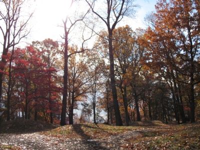
Entrance to Fort
SHOWN IN SOURCE-SPECIFIED ORDER
| On Chapman Highway SE north of Woodlawn Pike SE, on the left when traveling north. |
| | This Federal work was a major factor in the defense of Knoxville against Lt. Gen. Longstreet's assault in November, 1863. The fort and neighboring hills were manned by the 2nd Brigade(Cameron), 3rd Div., XXIII Corps, which repulsed by fire Wheeler's . . . — — Map (db m62514) HM |
| Near Fort Dickerson Road west of Chapman Highway, on the left when traveling north. |
| | –1863–
• One of sixteen Union Army earthen forts and battery positions protecting Knoxville, Nov. 1863–May 1865.
• Named for Capt. Jonathan C. Dickerson, 112th Illinois Mounted Infantry who was killed near Cleveland, TN . . . — — Map (db m4319) HM |
| Near Fort Dickerson Road west of Chapman Highway SW, on the left when traveling north. |
| | Introduction.
After defeating the Union Army of the Cumberland in the bloody battle of Chickamauga (Sep 18-20, 1863) and besieging the Federal provisions in the city of Chattanooga, Confederate Army of Tennessee Commander Gen. Braxton Bragg . . . — — Map (db m231248) HM |
| On Fort Dickerson Road west of Chapman Highway SW, on the left when traveling north. |
| |
What Brought the Armies of the Blue and the Gray to Knoxville?
Knoxville was a pro-Confederate town of some 3700 persons when Tennessee seceded from the Union in June of 1861. It was the commercial and light manufacturing center of East . . . — — Map (db m82201) HM |
| On Chapman Hwy SW north of Woodlawn Pike SE, on the left when traveling north. |
| | Fort Dickerson came under attack only once during the Civil War. in a prelude to the 1863 Siege of Knoxville, Federal and Confederate cavalry fought for possession of these heights. Its lofty presence, however, served as a deterrent until the end of . . . — — Map (db m4316) HM |
| On Fort Dickerson Road west of Chapman Hignway SW, on the left when traveling north. |
| | Fort Dickerson was one of the sixteen Federal forts and battery emplacements constructed around Knoxville during the Civil War. Temporary earthworks were thrown up here in November 1863. Designed by Capt. Orlando M. Poe, Chief Engineer of the Army . . . — — Map (db m4315) HM |
| On Chapman Hwy SW south of E Martin Mill Pike SE, on the right when traveling north. |
| | Fort Dickerson to the west and Fort Stanley to the east were the center two of four fortified heights held by the Federals south of the river during the siege of Knoxville, Nov. 17-Dec. 4, 1863. Maj. Gen. Jos. Wheeler C.S.A., made a vain effort to . . . — — Map (db m62515) HM |
May. 13, 2024