4 entries match your criteria.
Related Historical Markers
By Shane Oliver, July 10, 2020
Site of the Paoli Massacre Marker
SHOWN IN SOURCE-SPECIFIED ORDER
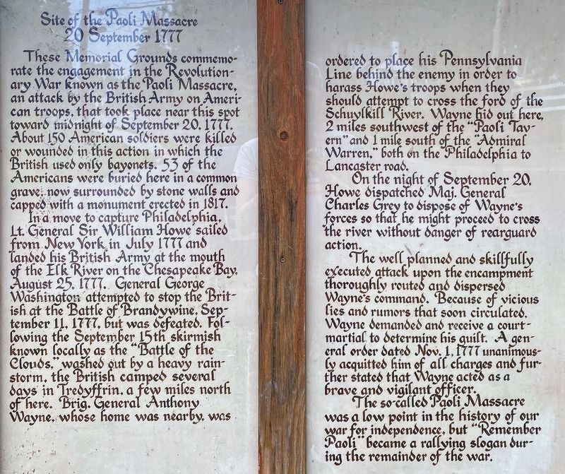
| | These Memorial Grounds commemorate the engagement in the Revolutionary War known as the Paoli Massacre, an attack by the British Army on American troops, that took place near this spot toward midnight of September 20, 1777. About 150 American . . . — — Map (db m13505) HM |
| | Massacre Farm North To E. Whiteland Included A Site. Southwest of This Marker. The 19th Century House and Springhouse, Headwater of Crum Creek. Were torn down in 1989 — — Map (db m48226) HM |
| | Since 1896, the 22-acre tract that is the final resting place for the victims of the Paoli Massacre has been under the watchcare and protection of the Paoli Memorial Association. In 1896, a small group of citizens petitioned the Court of Chester . . . — — Map (db m13664) HM |
| | The land on which the Battle of Paoli was fought has been farmland and woodland since the mid-18th century. Ezekiel Bowen, a farmer of Welsh descent, purchased this land in 1764. County records note that he sold it to Richard Mason of Philadelphia . . . — — Map (db m13619) HM |
May. 2, 2024