On Edgworth Road just west of Niagara River Parkway, on the right when traveling west.
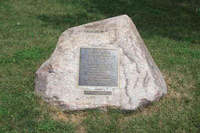
On this site was fought
The Battle of Chippawa
July 5, 1814.
Preservation of the Battleground
was made possible by
The Niagara Parks Commission
with the cooperation of
Frank and Mildred Branscombe,
River Realty . . . — — Map (db m49460) HM
On Niagara River Parkway just west of Edgworth Road, on the right when traveling south.
[Text on the West Side]:
Battle of Chippawa
5 July 1814
In memory of all those who fought on this ground, many of whom are buried nearby,
and to commemorate the peace that has prevailed between Canada and the . . . — — Map (db m49393) HM
Near Niagara River Parkway just west of Edgworth Road, on the right when traveling south.
On these fields and the surrounding woods 4,000 American, British, Canadian and Native forces fought the first major battle of the Niagara campaign of 1814. When the last shots died away on Samuel Street's farm, more than 800 lay dead and wounded. . . . — — Map (db m49398) HM
Near Niagara River Parkway just west of Edgworth Road, on the right when traveling south.
At dawn 5 July 1814, parties of Canadian-Militia and British allied Native Warriors scouted the American camp. They began sniping from the bushes on the north side of Street's Creek and this continued throughout the morning. Around noon, General . . . — — Map (db m49399) HM
Near Niagara River Parkway just west of Edgworth Road, on the right when traveling south.
Major General Phineas Riall, the British commander, had repaired the bridge over the Chippawa and ordered his own Regular light infantry, the local Canadians of the 2nd Lincoln Militia and a force of Native Warriors, to clear out the now scattered . . . — — Map (db m49400) HM
Near Niagara River Parkway just west of Edgworth Road, on the right when traveling south.
British General Riall was convinced that the greater part of Brown's army was still surrounding Fort Erie. He did not know the Fort had surrendered and he was facing the entire U.S. division. Still, the number of men deployed on both sides was . . . — — Map (db m49402) HM
Near Niagara River Parkway just west of Edgworth Road, on the right when traveling south.
As the battle raged, more American artillery deployed to the middle of the plain between the 11th U.S. and the lone 25th U.S. company, less than 100 meters (109 yards) from the British line. General Brown then led Ripley's brigade across Street's . . . — — Map (db m49403) HM
Near Niagara River Parkway just west of Edgworth Road, on the right when traveling south.
The Aftermath. In the days following the battle, General Brown's victorious troops advanced another 25 kilometers (18 miles) north to Fort George before retiring back to Niagara Falls when more British troops arrived in the area. They met the . . . — — Map (db m49404) HM
On Niagara River Parkway north of Edgworth Road, on the right when traveling south.
Here, on 5 July 1814, an American army under Major-General Jacob Brown launched the last major invasion of Canada during the War of 1812. The Americans defeated a British and Canadian force commanded by Major-General Phineas Riall consisting of . . . — — Map (db m49050) HM