Gen. Wm. T. Sherman camped in this area with his Left Wing on the night of March 18, 1865. The following morning, the Left Wing continued east along this road, meeting Gen. Joseph E. Johnston’s Confederates in the Battle of Bentonville, 2 miles . . . — — Map (db m218730) HM
Following the battle, 45 Confederate wounded were hospitalized in the Harper House.
Nineteen of these men died here. Surgeons moved others to regular Confederate hospitals. — — Map (db m218735) HM
Maj. Gen. A. S. Williams, commanding the XX Corps, established his headquarters here on March 19. In the woods to the north, the XX Corps erected breastworks which remain. — — Map (db m222887) HM
Field hospital of the XX Corps during the Battle of Bentonville was located here. Four hundred Union soldiers, wounded in the Battle of Averasboro (16 miles west) on March 16, were brought here for treatment. — — Map (db m218732) HM
In the forests and fields around the North Carolina village of Bentonville, the armies of Confederate Gen. Joseph E. Johnston and Union Gen. William T. Sherman fought their last major engagement of the Civil War on March 19-21, 1865. Sherman was . . . — — Map (db m222865) HM
(Preface): The Carolinas Campaign began on February 1, 1865, when Union Gen. William T. Sherman led his army north from Savannah, Georgia, after the “March to the Sea.” Sherman's objective was to join Gen. Ulysses S. Grant in Virginia . . . — — Map (db m222866) HM
(Front Inscription):
Texas
remembers the valor and devotion of her sons who served at Bentonville March 19-21, 1865
The eighth Texas cavalry was engaged with the left wing of Sherman’s Union army on the eve of the Battle of . . . — — Map (db m222881) HM
In memory of the North Carolina soldiers who fought and died so courageously and the civilians who suffered so grievously during the Battle of Bentonville. March 19-21, 1865. Reverse: Sleep, soldier, sleep, in thy rough earthen tomb. While . . . — — Map (db m222879) HM
In memory of the Confederate dead Erected under the auspices of Goldsboro Rifles October 10, 1894. ♦♦♦ [ Left of Monument: ] On this spot and in this vicinity was fought the Battle of Bentonville March 19, 1865. . . . — — Map (db m222884) HM
“Time may teach us to forgive, but it can never make us forget.” - Confederate Lt. Gen. Wade Hampton, memorial address at Bentonville, March 20, 1895. By the evening of March 22, 1865 both the Union and Confederate armies had vacated . . . — — Map (db m222883) HM
The remains of 360 Confederates who fell in the Battle of Bentonville lie here. They were moved to this plot from other parts of the battlefield in 1893. The monument was erected at that time. — — Map (db m222876) HM
Constructed by First Michigan Engineers and others, March 19, 1865. Occupied by Federals throughout the battle. Works begin 75 yards behind this marker. — — Map (db m222868) HM
The depression in front of you is the remnant of trenches dug by the 1st Regiment Michigan Engineers and Mechanics. In addition to field works such as trenches, the members of the regiment built bridges, warehouses, and blockhouses. Perhaps most . . . — — Map (db m222874) HM
“Defender of the Southland to the end” In memory and honor of Confederate soldiers who fought at Bentonville Battlefield, North Carolina during March 19-21, 1865 Erected by Sons of Confederate Veterans Dedicated March 20, 2010 Sculptor: Carl W. . . . — — Map (db m222886) HM
God Bless the Tar Heel Boys - Quote attributed to Gen. R. E. Lee in R. B. Creecy’s Grandfather Tales of North Carolina History, 1901. Many people know that North Carolina is nicknamed the “Tar Heel State,” but not everyone may . . . — — Map (db m222913) HM
Union batteries (26 guns) formed a line here, March 19. These guns covered retreating Federals during the Confederate charges and finally halted the advance of the Confederate Right Wing. — — Map (db m222890) HM
You are standing at the Morris farm, where part of the Union XX Corps arrived late in the afternoon on March 19,1865, to stop the main Confederate assault, which had crushed Carlin’s division of the XIV Corps at the Cole plantation. In the morning . . . — — Map (db m222903) HM
Across the fields behind this marker the Confederate Right Wing made five attacks on Union positions to the left, March 19, 1865. They were thrown back by the XX Federal Corps. — — Map (db m222892) HM
A point approximately 400 yards in front of you marks the center of a line of Union cannons positioned on the Morris Farm on March 19, 1865. These massed guns played a significant role in blunting the final Confederate attacks on the first day of . . . — — Map (db m222911) HM
After overrunning two Union lines above this road, the Confederates crossed here in the main assault of March 19, 1865.
Union reinforcements halted their advance in the woods below the road. — — Map (db m222894) HM
One-half mile south of this point, across the road, Brig. Gen. J. D. Morgan’s Union Division halted the main Confederate charge, March 19, 1865, in one of the fiercest engagements of the battle. — — Map (db m222895) HM
Brig. Gen. W. P. Carlin’s Division attacked the Confederate line above the road here on March 19. Repulsed, they threw up works but were driven out by the Confederate charge. — — Map (db m222900) HM
You are looking north of the Goldsboro Road at the site of the former William Cole plantation. Lt. Gen. Wade Hampton chose this ground (a mixture of dense vegetation and open fields) as an ideal location for Confederate forces to block the advance . . . — — Map (db m222904) HM
Directly in front and to your left, Confederate Maj. Gen. Robert F. Hoke’s division, on loan from the Army of Northern Virginia, blocked the old Goldsboro Road (now Harper House Road) to deflect the oncoming Union advance. The division was a mixed . . . — — Map (db m222908) HM
You are looking south of the Goldsboro Road at the area where Union Brig. Gen. James D. Morgan’s division began a defensive position facing Gen. Robert F. Hoke’s division after being deflected by the main Confederate line. These battle-hardened . . . — — Map (db m222906) HM
The Confederate Left Wing, part of a long hook-shaped line designed to trap the Union forces, extended across the road here on March 19. This sector, occupied by Maj. Gen. R. F. Hoke’s Division, was evacuated on March 20. A new line parallel to the . . . — — Map (db m222916) HM
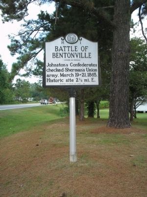
This memorial marks the battlefield of Bentonville where, on March 19-21, 1865, General Joseph E. Johnston, with about 15,000 Confederate troops, principally from North Carolina, South Carolina, Georgia Tennessee, Alabama, and Mississippi, checked . . . — — Map (db m222917) HM
(Preface):The Carolinas Campaign began on February 1, 1865, when Union Gen. William T. Sherman led his army north from Savannah, Georgia, after the “March to the Sea.” Sherman's objective was to join Gen. Ulysses S. Grant in Virginia to crush . . . — — Map (db m222921) HM
In front of you is where the North Carolina Junior Reserves stood as the Army of Tennessee made its last grand charge against Carlin’s division at the Cole plantation on March 19, 1865. Three regiments and one battalion of Junior Reserves were . . . — — Map (db m222920) HM
Held the line along this road and repulsed the assault of Hobart’s Union Brigade, March 19, 1865. This line was evacuated, March 20. — — Map (db m222924) HM
In 1865, a local market center for naval stores (tar, pitch & turpentine). Bentonville gives name to the battle fought nearby, March 19-21, 1865. Confederates concentrated here the day before the battle. As they retreated on March 22, they burned . . . — — Map (db m222959) HM
(Preface):The Carolinas Campaign began on February 1, 1865, when Union Gen. William T. Sherman led his army north from Savannah, Georgia, after the “March to the Sea.” Sherman's objective was to join Gen. Ulysses S. Grant in Virginia to . . . — — Map (db m222962) HM
The flooded state of this creek upstream prevented an attack by Wheeler’s Confederate cavalry on the rear of Sherman’s Army, March 19, 1865. A bridge here was the Confederates’ sole line of retreat after the battle. — — Map (db m222964) HM
In the field in front of you skirmishers from the 64th Illinois, armed with Henry repeating rifles, overran Gen. Joseph E. Johnston’s headquarters, forcing the general and his staff to flee on foot toward Bentonville (to your left). Maj. Gen. Joseph . . . — — Map (db m222957) HM
To your front and left, Confederate forces counterattacked Union forces under Maj. Gen. Joseph Mower on three sides. Leading a counterattack to protect the vital Mill Creek bridge – the only avenue of retreat for Johnston’s army – Gen. William . . . — — Map (db m222953) HM
You are looking at the village of Bentonville. This small hamlet bore the name of the largest battle ever fought in North Carolina. Named after local resident John Benton, the hamlet had a post office as early as 1849. In the 1860s Bentonville was a . . . — — Map (db m222958) HM
Established here on the night of March 18, 1865 and remained during the battle.
Mower’s Division came within 200 yards of this point in the Union assault of March 21. — — Map (db m222955) HM
Near this point Gen. William J. Hardee led the charge of the 8th Texas Cavalry and other Confederates, repulsing the advance of Mower’s Division, March 21, 1865. — — Map (db m222948) HM
Advancing toward Mill Creek Bridge, Johnston’s only line of retreat, Maj. Gen. J. A. Mower’s Union Division broke the Confederate line near this point, March 21. Mower’s Division reached a point 200 yards from Johnston’s headquarters before it was . . . — — Map (db m222949) HM
After withdrawing from the advance against Mill Creek Bridge, Mower’s Federals re-formed here and threw up works. This was the extreme right of the Union line on March 21. Earthworks remain. — — Map (db m222951) HM
Trenches in the woods behind this marker formed the extreme right of the Union line on March 20. This sector was occupied by the XVII Corps, commanded by Maj. Gen. F. P. Blair. — — Map (db m222946) HM
Sherman’s headquarters were located in the field 400 yards to the rear of this marker, March 20-21, 1865. Headquarters of the XVII Corps, which included Mower’s Division, were 250 yards to the left rear. — — Map (db m222939) HM
Sherman’s Left and Right Wings joined forces here during the afternoon of March 20, 1865. They constructed works across the road and skirmished with the Confederates. — — Map (db m222928) HM
Advanced to this point during the afternoon of March 21. The XV Corps established a line of works across the road here. Earthworks remain. — — Map (db m222936) HM
Crossed the road at this point, March 20-21. Gen. R. F. Hoke’s Division occupied this sector. Scene of much skirmishing but no heavy fighting. Earthworks remain. — — Map (db m222938) HM