5 entries match your criteria.
Related Historical Markers
Markers in the Red Rock Overlook Park
By Craig Swain, April 2, 2008
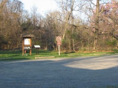
Trailhead seen from the Parking Lot
SHOWN IN SOURCE-SPECIFIED ORDER
| | Red Rock Wilderness Overlook Regional Park is a 67-acre mostly wooded area situated along the Potomac River on the outskirts of Leesburg. Frances Speek donated a portion of the property to the Northern Virginia Regional Park Authority in 1978. The . . . — — Map (db m7820) HM |
| | The carriage house was used for storage of house drawn carriages and other equipment. This building was constructed in the 1880s and was in use until the 1930s. After horse drawn carriages were no longer commonly used, the building was used as a . . . — — Map (db m7831) HM |
| | The two-chambered granary was used for storing threshed grain until it was either sold or consumed. The presence of two chambers indicates that the owner could grow two different crops and store them simultaneously. Grain was often transported . . . — — Map (db m7832) HM |
| | The well house was constructed of poured concrete and was used for storing water on the farm. One room housed a pump, which drew water from a shallow well outside. The second room housed a cistern that was used for storing water after it had been . . . — — Map (db m7834) HM |
| | In winter this building was filled with ice cut from the Potomac River. The tick stone walls and many layers of straw provided sufficient insulation to preserve a supply of ice for summer use. When the family needed ice, large chucks were retrieved . . . — — Map (db m7836) HM |
Apr. 29, 2024