15 entries match your criteria.
South Carolina, Anderson County Historical Association/Society Historical Markers
The first historical preservation organization in Anderson County, South Carolina.
By Brian Scott, January 2, 2013
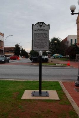
Anderson: "The Electric City" Marker
Present Location, Reverse
| On South Main Street (State Highway 28) at West Whitner Street (State Highway 24), on the right when traveling west on South Main Street. |
| On Broadway Lake Road at Belton Highway (U.S. 178), on the right when traveling east on Broadway Lake Road. |
| On West Whitner Street (State Highway 24) west of State Highway 1028, on the right when traveling west. |
| On North McDuffie Street at Whitner Street, on the right when traveling south on North McDuffie Street. |
| On South Main Street (State Highway 28) at Johnson Street, on the right when traveling south on South Main Street. |
| On Lowndesville Highway (State Highway 81) south of West Cruette Street, on the left when traveling north. |
| On Elberton Highway (State Highway 184) at Sam Turner Road, on the right when traveling west on Elberton Highway. |
| On North Mechanic Street (State Highway 28) near West Main Street, on the right when traveling north. |
| On East Queen Street near Exchange Street. |
| On East Queen Street (State Highway 88) at North Broad Streets, on the right when traveling north on East Queen Street. |
| On Savannah River Scenic Byway (State Highway 24) 0.1 miles east of Keowee Club Road, on the left when traveling east. |
| On East Greenville Street at Hamilton Street, on the right when traveling west on East Greenville Street. |
| On West Main Street (State Highway 20), on the left when traveling south. |
May. 7, 2024