The African American Storyline Project Historical Markers
"The African American Storyline Project" is a historical initiative that documents and preserves African American history and culture in Brevard, NC. The signs highlight the locations of Black-owned businesses that once stood in these spots. In some cases, the buildings still stand, in others, they are just a memory.
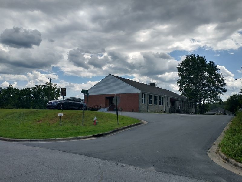
On Rosenwald Lane at West Main Street, on the right when traveling north on Rosenwald Lane.
The “old” Rosenwald School was a four room frame building, built in 1910. The school was located near the junction of West Main Street and Rosenwald Lane. When the school mysteriously burned down in 1941, students had school in churches and other . . . — — Map (db m287255) HM
On Carver Street at Oakdale Street, on the right when traveling north on Carver Street.
Founded in 1919 under the Pastorate of Reverend M.C. Rice and about 4 members of Bethel Baptist Church. The original church was located near the junction of Carver and Oakdale Streets. The present sanctuary was built in 1978 on the site of what was . . . — — Map (db m287286) HM
On Mills Avenue north of Brown Lane, on the left when traveling north.
Bethel Baptist is the oldest African American church in Transylvania County. Prior to 1865, African American Baptists in the County attended Cathey’s Creek church. As slaves, they were relegated to the back of the church. Their participation was . . . — — Map (db m287346) HM
On Carver Street at Cunningham Drive, on the left when traveling north on Carver Street.
Condrey Sharp and his wife, Susan, operated their home as a boarding house for several years. It was located at the deep curve on Carver Street, near Eliza’s 2-story rooming house.
“The African American Storyline Project” (A Transylvania . . . — — Map (db m287291) HM
On Carver Street at Cunningham Drive, on the left when traveling north on Carver Street.
Eliza “Mother Liza” Cunningham operated Eliza’s Rooming House for many out of town workers. To get to the two story frame house, you would travel down Carver Street to the first deep curve, before heading up the hill on a dirt and gravel road. . . . — — Map (db m287290) HM
On Oakdale Street at Jenkins Row, on the right when traveling west on Oakdale Street.
The Fire Baptized Holiness Church, founded in 1919 under the Pastorate of Reverend Ella Adams, was a log cabin, the last such church building in the area. The cabin has been torn down for a number of years. It was located on Oakdale Street, near the . . . — — Map (db m287350) HM
On Mills Avenue north of Hillview Circle, on the left when traveling north.
Georgia Hill was the name given to the group of black people who came up to Brevard in the 1920’s from Georgia. Together with Georgia Hill, several smaller neighborhoods (Goose Hollow, Greasy Corner, Hemphill Circle and The Flats) actually made up . . . — — Map (db m287344) HM
On Rosenwald Lane at West Main Street, on the right when traveling north on Rosenwald Lane.
Goose Hollow refers to an area along West Main Street, extending past the Rosenwald School to the bottom of the hill. People in the area enjoyed being outside. While washing their clothes, they used to yell at each other. Reportedly one day, Homer . . . — — Map (db m287254) HM
On Thomas Street at West Main Street, on the left when traveling north on Thomas Street.
Located off of Thomas and West Main Street, the housing complex consisting of 10 apartments, were built around 1958. The people were so pleasant that the area became known as “Happy Hollow”. The property was owned by Evelena Brown and built by Leroy . . . — — Map (db m287253) HM
On Carver Street at Cunningham Drive, on the left when traveling north on Carver Street.
In the 1960’s, Mr. Henry Hutchison operated Henry’s Barber Shop. It was located near Betsill’s Barber Shop. Once Betsill’s closed, Henry’s was the only barber shop in the black community. The building also housed the very popular Green Onion Dinner . . . — — Map (db m287289) HM
On South Oaklawn Avenue at Fortune Lane, on the left when traveling north on South Oaklawn Avenue.
James “Jim” P. Aiken and his wife, Mary, had a daughter known to the world as "Moms Mabley." Loretta (Moms) was well known on stage, screen and television.
At the time of Jim Aiken’s death, he owned a total of six houses, was a prominent black . . . — — Map (db m287251) HM
On Carver Street, on the right when traveling south. Reported missing.
Opening in 1952 against the backdrop of segregation, the MCJCC has been a vital part of historic Rosenwald for 60+ years. It became the hub of entertainment, activity and fellowship for the black community. Mary B. Kilgore imagined this central . . . — — Map (db m287352) HM
On Carver Street at Jordan Lane, on the left when traveling north on Carver Street.
In 1896, a frame structured building was erected for this church. The site was a lot located beside the current Masonic Lodge Building. In 1954, the church was torn down because of its deteriorating condition.
“The African American Storyline . . . — — Map (db m287287) HM
On Carver Street north of Jordan Lane, on the left when traveling north.
On or about 1905, the Masons were organized under the name Mountain Lily Lodge 117. The members later joined the Odd Fellows, in securing the lodge hall building. The Lodge was located on the second floor of the two story building, while Victor . . . — — Map (db m287288) HM
On Carver Street at Oakdale Street, on the right when traveling south on Carver Street.
Edward Killian was the first African-American to operate a taxi business in Brevard. His company was in business at this central location until the 1950’s.
“The African American Storyline Project” (A Transylvania Citizen’s Improvement . . . — — Map (db m287283) HM
On Carver Street at Oakdale Street, on the right when traveling south on Carver Street.
This café was first operated by Mr. Mack Butler and later by Mr. Grady Elliot in the 1940’s and early 1950’s. The frame building was located across the street from Bethel “A” Baptist Church.
“The African American Storyline Project” (A . . . — — Map (db m287285) HM
On Mills Avenue at Brown Lane, on the right when traveling north on Mills Avenue.
From 1917 to about 1956, the Reverend J.F.W. “Jip” Mills owned and operated a grocery store here. For about five cents each, you could buy sugar, baloney and large bags of candy.
“The African American Storyline Project” (A Transylvania . . . — — Map (db m287348) HM
On Carver Street at Oakdale Street, on the right when traveling south on Carver Street.
During segregation days, numerous businesses and enterprises were located in Rosenwald. Mrs. Annie Bell Killian operated a popular grocery store from 1935 to 1960. The store’s location was just across the street from Bethel “A” Baptist Church. Mr. . . . — — Map (db m287284) HM
On Rosenwald Lane, on the right when traveling north.
Built in 1948 to replace the old wooden school which burned down in 1941. The Rosenwald School was built at a maximum cost of $136,000, serving grades 1 through 8. Without a high school in the county that black students were allowed to attend, . . . — — Map (db m287257) HM