Marker Logo HMdb.org THE HISTORICAL
MARKER DATABASE
“Bite-Size Bits of Local, National, and Global History”


After filtering for Newfoundland and Labrador, 5 entries match your criteria.  


Exploration Topic
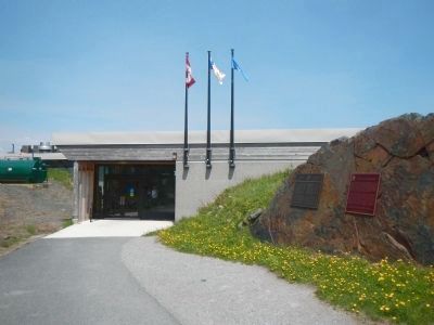
 
L’Anse aux Meadows Marker image, Touch for more information
By Barry Swackhamer, June 28, 2014
L’Anse aux Meadows Marker
1 Newfoundland and Labrador, Great Northern Peninsula, Newfoundland, St Lunaire-Griquet — L’Anse aux Meadows
Near Newfoundland and Labrador Route 436 close to Newfoundland and Labrador Route 430.
2 Newfoundland and Labrador, Great Northern Peninsula, Newfoundland, St Lunaire-Griquet — The End of a Quest: L’aboutissement d’une quêteFishing for the Past: À la recherche du passé
Near unnamed road close to Newfoundland and Labrador Route 43.
3 Newfoundland and Labrador, Humber Valley, Newfoundland, Corner Brook — Captain James Cook, R.N.Le capitaine James Cook
Near Mayfair Avenue.
4 Newfoundland and Labrador, Humber Valley, Newfoundland, Corner Brook — Cook comes to Canada
Near Mayfair Avenue.
5 Newfoundland and Labrador, Labrador, Red Bay — Basque Whalers in the Strait of Belle IsleLes baleiners Basques dans la détroit de Belle Isle
Near unnamed road.


CeraNet Cloud Computing sponsors the Historical Marker Database.
This website earns income from purchases you make after using our links to Amazon.com. We appreciate your support.
Paid Advertisement
May. 4, 2024