English:
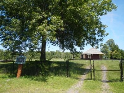
The St. Lawrence Parks Commission gratefully acknowledges the Save the Train Committee’s contribution of time and effort to fundraise and assist with the joint restoration project of the Aultsville Train Station.
Aultsville . . . — — Map (db m82244) HM
English:
Here, on the farm of John Crysler, was fought one of the decisive battles of the War of 1812. On 11 November 1813 Lieutenant-Colonel Joseph Morrison, with 800 British and Canadian regulars, militia and Indians, engaged an . . . — — Map (db m82184) HM
In November, 1813, an American army of some 8000 men, commanded by Major-General James Wilkinson, moved down the St. Lawrence en route to Montreal. Wilkinson was followed and harassed by a British “corp of observation” consisting of . . . — — Map (db m82180) HM
These plaques are found in the British Court of Honour and the Canadian Court of Honour at the Crysler's Farm Battlefield visitors center.
Battlefield
of Chrysler’s Farm
Pro Patria
In Memory of
Captain Thomas Nairne . . . — — Map (db m82182) WM
Top Row — left, small Pres built 1831 purchased by Catholics 1845 present Catholic cen. left 1968 — — old & present Presbyterian 1873 located in Dunbar — — United Church in Williamsburg former Presbyterian 1866 — . . . — — Map (db m150218) HM
In honour of George H. Challies who was responsible for the creation and development of the St. Lawrence Parks and Upper Canada Village. At the age of 73, in conjunction with the Seaway and Power Development of the St. Lawrence River, a project . . . — — Map (db m150231) HM
Born in Williamsburg and educated at the Cornwall Grammar School, Whitney was called to the Bar in 1876. He was elected to the legislative assembly as Conservative member for Dundas in 1888. A noted orator, he was leader of the opposition . . . — — Map (db m82248) HM
The first Lutheran minister to settle in this province, Schwerdtfeger was born in Burgbernheim, Bavaria, and studied theology at the University of Erlangen. Emigrating to America in 1753, he served as pastor of congregations in Pennsylvania, . . . — — Map (db m86847) HM
The canals at Farran's Point, Rapide Plat and Galops were known collectively as the Williamsburg Canals. All three were built in the period 1844-56 on the north side of the St. Lawrence to form part of the Great Lakes navigation system. Farran's . . . — — Map (db m86848) HM
Jubilant & relieved family members & friends greeted soldiers returning home after the Second World War. Over 250 Morrisburg citizens served in W.W. II. Morrisburg’s train station stood at this site until 1958 when it was demolished and relocated to . . . — — Map (db m150215) HM WM