French Quarter in New Orleans in Orleans Parish, Louisiana — The American South (West South Central)
Upper Pontabla Building
— Pontabla Buildings National Historic Landmark —
Logo of the Orleans Parish Landmarks Commission
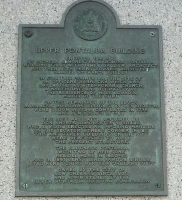
by Michela Almonester, Baroness Pontabla,
working first with James Gallier, architect
and then with Henry Howard, architect
Samuel Stewart, builder.
In 1724 this corner was the site of
an officers’ barracks which was
later used as a temporary church,
a warehouse, and ultimately as
the residence of M. de Loubois,
major of the town.
On the remainder of the block,
barracks buildings designed by I. F. Broutin
were begun in 1734, completed in 1738
and demolished in 1769.
The site was later acquired
by Don Andres Almonester y Roxas
whose widow erected an imposing mansion
on the Decatur Street corner in 1811.
This and other buildings on the site
were demolished to build the present structure.
The Baroness Pontabla,
with two of her sons,
resided here in 1850-51,
and in 1851 Jenny Lind, famous singer,
lived here during her New Orleans visit.
Owned by the City of
New Orleans since 1930
and administered by the
Upper Pontabla Building Commission.
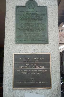
[Panel 2:]
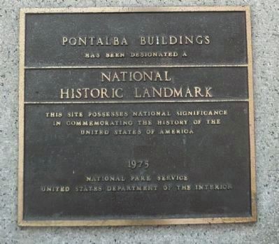
has been designated a
National
Historic Landmark.
This site possesses national significance
in commemorating the history of the
United States of America.
1975
National Park Service
United States Department of the Interior.
Erected 1975 by the Orleans Parrish Landmarks Commission and the National Park Service.
Topics and series. This historical marker is listed in these topic lists: Architecture • Churches & Religion • Colonial Era • Forts and Castles • Hispanic Americans • Settlements & Settlers • War, French and Indian • Women. In addition, it is included in the National Historic Landmarks series list. A significant historical year for this entry is 1724.
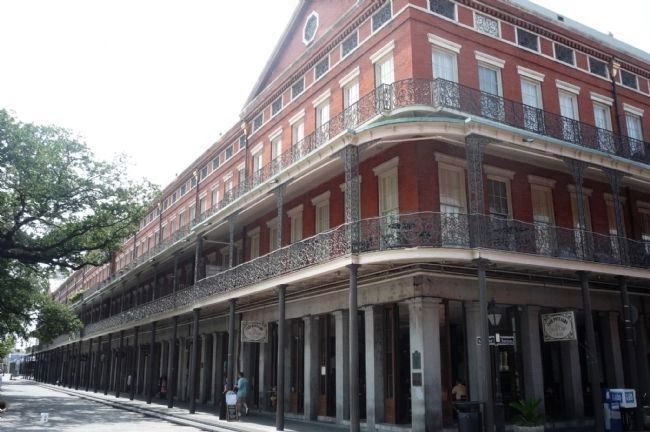
Location. 29° 57.44′ N, 90° 3.83′ W. Marker is in New Orleans, Louisiana, in Orleans Parish. It is in the French Quarter. Marker is on St. Peter Street south of Chartres Street, on the left when traveling north. The two panels are off the sidewalk, together on the northwest corner column of the Upper Pontabla Building. They are diagonally across Chartres Street from the Cabildo National Historic Landmark and across St. Peter Street from the Jackson Square National Historic Landmark. Touch for map. Marker is at or near this postal address: 500 St Peter Street, New Orleans LA 70116, United States of America. Touch for directions.
Other nearby markers. At least 8 other markers are within walking distance of this marker. Literary Landmark (a few steps from this marker); Napoleon 12-pounder cannon (a few steps from this marker); The Cabildo (a few steps from this marker); To the French Patriots of 1768 (within shouting distance of this marker); a different marker also named The Cabildo (within shouting distance of this marker); Spanish cannon (within shouting distance of this marker); Don Bernardo de Galvez (within shouting distance of this marker); a different marker also named The Cabildo (within shouting distance of this marker). Touch for a list and map of all markers in New Orleans.
Also see . . .
1. Madame Pontabla's Buildings. . . . NOTE: The Upper Pontabla Building is located directly across Jackson Square from its twin (the "Lower" Pontabla Building) at 500 St. Ann Street. (Submitted on August 9, 2009, by Richard E. Miller of Oxon Hill, Maryland.)
2. Louisiana State Museum - "1850 House," Lower Pontabla Building. (Submitted on August 13, 2009, by Richard E. Miller of Oxon Hill, Maryland.)
Credits. This page was last revised on February 12, 2023. It was originally submitted on August 9, 2009, by Richard E. Miller of Oxon Hill, Maryland. This page has been viewed 1,500 times since then and 26 times this year. Photos: 1. submitted on August 9, 2009, by Richard E. Miller of Oxon Hill, Maryland. 2. submitted on August 14, 2009. 3, 4. submitted on August 9, 2009, by Richard E. Miller of Oxon Hill, Maryland. • Syd Whittle was the editor who published this page.


