Middletown in Butler County, Ohio — The American Midwest (Great Lakes)
The Miami & Erie Canal in Middletown
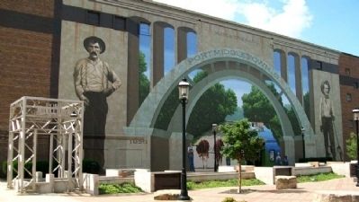
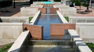
Port Middletown Plaza
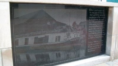
Ohio's canal system was the most effective between 1827 and 1850, before the introduction of the railroads. In Middletown, the canal was still used well into the 20th century but in 1913 a devastating flood destroyed much of the canal. In 1929 water was drained from the canal and the canal bed was filled in, paved and dedicated in 1938 as Verity Parkway.
[Photo] Left, in 1906 the line boat Excello, captained by Earl Winter, was the last regular canal boat taken out of Middletown.
Erected by City of Middletown, the Middletown Historical Society, and Others.
Topics. This historical marker is listed in these topic lists: Disasters • Industry & Commerce • Man-Made Features • Notable Events • Roads & Vehicles • Waterways & Vessels. A significant historical year for this entry is 1827.
Location. 39° 30.963′ N, 84° 24.153′ W. Marker is in Middletown, Ohio, in Butler County. Marker is at the intersection of Central Avenue (Ohio Route 122) and N. Verity Parkway (Ohio Route 73), on the right when traveling west on Central Avenue. Touch for map. Marker is in this post office area: Middletown OH 45044, United States of America. Touch for directions.
Other nearby markers. At least 8 other markers are within walking distance of this marker. Ohio Canals (here, next to this marker); Port Middletown (here, next to this marker); Canal Boats (here, next to this marker); Canal Locks (here, next to this marker); The Miami & Erie Canal Lift Bridge (here, next to this marker); World War II Veterans Memorial Bench (approx. ¼ mile away); Middletown War Memorial Flagpole (approx. 0.6 miles away); Underground Railroad Route (approx. 0.6 miles away). Touch for a list and map of all markers in Middletown.
Also see . . .
1. Miami & Erie Canal. (Submitted on May 7, 2010, by William Fischer, Jr. of Scranton, Pennsylvania.)
2. Miami and Erie Canal. Wikipedia entry (Submitted on June 20, 2022, by Larry Gertner of New York, New York.)
Credits. This page was last revised on June 20, 2022. It was originally submitted on May 7, 2010, by William Fischer, Jr. of Scranton, Pennsylvania. This page has been viewed 2,140 times since then and 110 times this year. Photos: 1, 2. submitted on May 7, 2010, by William Fischer, Jr. of Scranton, Pennsylvania. 3, 4. submitted on May 6, 2010, by William Fischer, Jr. of Scranton, Pennsylvania.


